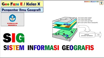
What is GIS?
Summary
TLDRThis video explores the significance of Geographic Information Systems (GIS) in various sectors, emphasizing its role in assessing risks, managing resources, and enhancing community engagement. It illustrates how GIS aids decision-making for businesses, governmental bodies, and conservation efforts, addressing critical global challenges like poverty and climate change. By integrating vast data layers, GIS enables a comprehensive understanding of spatial relationships, making it indispensable for planning and sustainable development. As the GIS industry grows, its ability to foster informed decisions becomes increasingly vital for shaping a better future.
Takeaways
- 🌍 GIS (Geographic Information Systems) combines various data sources to help understand spatial relationships and manage risks effectively.
- 💧 GIS is crucial for assessing flood risks, allowing homeowners to determine their vulnerability based on layered data like floodplains and rainfall.
- 🏙️ Cities use GIS to manage land use, utilities, and transportation systems, improving decision-making, especially in underserved communities.
- 📈 Businesses leverage GIS for optimizing supply chains and selecting store locations by analyzing customer demographics and competition.
- 🚨 GIS enhances emergency response efforts by facilitating real-time collaboration among first responders and providing comprehensive data access.
- 🌱 Environmental organizations like IUCN utilize GIS to inform conservation strategies and ensure inclusive decision-making through visual data.
- 📊 The Sustainable Development Goals (SDGs) rely on GIS for tackling global issues such as poverty, hunger, and healthcare accessibility.
- 🔍 GIS allows for the visualization of complex data, making it indispensable in understanding and addressing societal challenges.
- 📈 The GIS industry is projected to double by 2027, highlighting its growing importance across various sectors.
- ⚡ GIS technology enables innovative solutions to complex issues, making it a powerful tool for future planning and development.
Q & A
What is GIS and why is it important?
-GIS, or Geographic Information Systems, is a tool that helps visualize and analyze spatial data. It is important because it allows us to understand relationships between different data points in a geographic context, which is crucial for decision-making in various fields.
How can GIS help individuals assess flood risk?
-GIS can provide information about whether a home is located in a floodplain, drainage patterns, rainfall data, and future changes, allowing homeowners to assess their flood risk effectively.
In what ways is GIS used by corporations?
-Major corporations use GIS to manage supply chains, determine store locations, and optimize operations by analyzing spatial relationships and data.
How does GIS benefit marginalized communities?
-GIS allows for better problem-solving by providing comprehensive data layers that can highlight the needs and circumstances of marginalized communities, enabling more effective interventions.
What future trends are anticipated for the GIS industry?
-The GIS industry is expected to double in size by 2027, indicating a growing reliance on geographic data for various applications.
What role does GIS play in agriculture?
-In agriculture, GIS helps farmers make informed decisions about crop planning by analyzing soil data, weather patterns, and other relevant information.
How does GIS enhance collaboration during emergency responses?
-GIS allows different departments and first responders to access the same data portal, facilitating real-time collaboration and informed decision-making during emergencies.
Why is GIS essential for the Sustainable Development Goals?
-GIS is crucial for the Sustainable Development Goals as it helps identify the geographic distribution of issues like poverty and hunger, enabling targeted solutions based on data.
How can GIS be utilized in conservation efforts?
-GIS aids conservation by helping visualize and organize data related to both human and wildlife needs, enabling better planning for coexistence and protection of natural resources.
What is the relationship between GIS and climate change?
-Understanding and addressing challenges related to climate change requires a geographic context, and GIS provides the necessary tools to analyze and visualize these complex relationships.
Outlines

Dieser Bereich ist nur für Premium-Benutzer verfügbar. Bitte führen Sie ein Upgrade durch, um auf diesen Abschnitt zuzugreifen.
Upgrade durchführenMindmap

Dieser Bereich ist nur für Premium-Benutzer verfügbar. Bitte führen Sie ein Upgrade durch, um auf diesen Abschnitt zuzugreifen.
Upgrade durchführenKeywords

Dieser Bereich ist nur für Premium-Benutzer verfügbar. Bitte führen Sie ein Upgrade durch, um auf diesen Abschnitt zuzugreifen.
Upgrade durchführenHighlights

Dieser Bereich ist nur für Premium-Benutzer verfügbar. Bitte führen Sie ein Upgrade durch, um auf diesen Abschnitt zuzugreifen.
Upgrade durchführenTranscripts

Dieser Bereich ist nur für Premium-Benutzer verfügbar. Bitte führen Sie ein Upgrade durch, um auf diesen Abschnitt zuzugreifen.
Upgrade durchführenWeitere ähnliche Videos ansehen
Sistem Informasi Geografis | Geografi Kelas 10 - KHATULISTIWA MENGAJAR

Apa perbedaan SaIG dan SIG? | SAIG2B

Sistem Informasi Geografi (SIG) bagian 1

Konsep Dasar Sistem Informasi Geografi (SIG)
Sistem Informasi Geografis # kurikulum merdeka.

GEOSPATIAL TECHNOLOGY FOR DISASTER MANAGEMENT (DDR) Disaster Risk Reduction
5.0 / 5 (0 votes)
