Letusannya 30.000 kali dari Ledakan Bomb Atom Hiroshima, Inilah Krakatau
Summary
TLDRKrakatau, known internationally as Krakatoa, is an active volcanic island in the Sunda Strait between Java and Sumatra, Indonesia. It's part of the Ujung Kulon National Park and a UNESCO World Heritage site. The 1883 eruption was one of the deadliest and most destructive volcanic events, causing global climate changes and lowering temperatures. The eruption led to tsunamis, volcanic ash clouds, and the temporary dimming of the sun. Krakatau's geological history includes the ancient Krakatoa, which erupted around 535 CE, and the emergence of 'Anak Krakatau' in 1927, which has been active since.
Takeaways
- 🌋 Krakatau, also known as Rakata, is an active volcanic island located between Java and Sumatra in Indonesia.
- 🏞️ The Krakatau archipelago is a protected area, declared a national park in 1980 and a UNESCO World Heritage Site in 1991.
- 🔍 The volcanic system of Krakatau originated from a single volcanic mountain that erupted catastrophically in the past.
- 🌍 The 1883 eruption of Krakatau is one of the deadliest and most destructive volcanic events in recorded history, causing global climate changes.
- 🌡️ The eruption led to a significant drop in global temperatures, with the average summer temperature in the Northern Hemisphere dropping by 0.4 degrees Celsius.
- 🌅 The aftermath of the eruption resulted in spectacular sunsets worldwide, as documented by the English artist William Ascroft.
- 📈 The eruption of Krakatau was the first natural disaster to have a truly global impact, coinciding with the rapid development of telegraph and undersea cable communications.
- 🗻 The original Krakatau mountain, known as Krakatau Pasha, was estimated to have been 2000 meters high before its catastrophic eruption in 535 CE.
- 🌿 The 1883 eruption completely destroyed most of the island, and the area has since regenerated into a lush forest and is now part of Ujung Kulon National Park.
- 📊 The eruption released an estimated 200 megatons of energy, equivalent to about 4 times the power of the largest thermonuclear bomb ever detonated.
Q & A
What is Krakatau and where is it located?
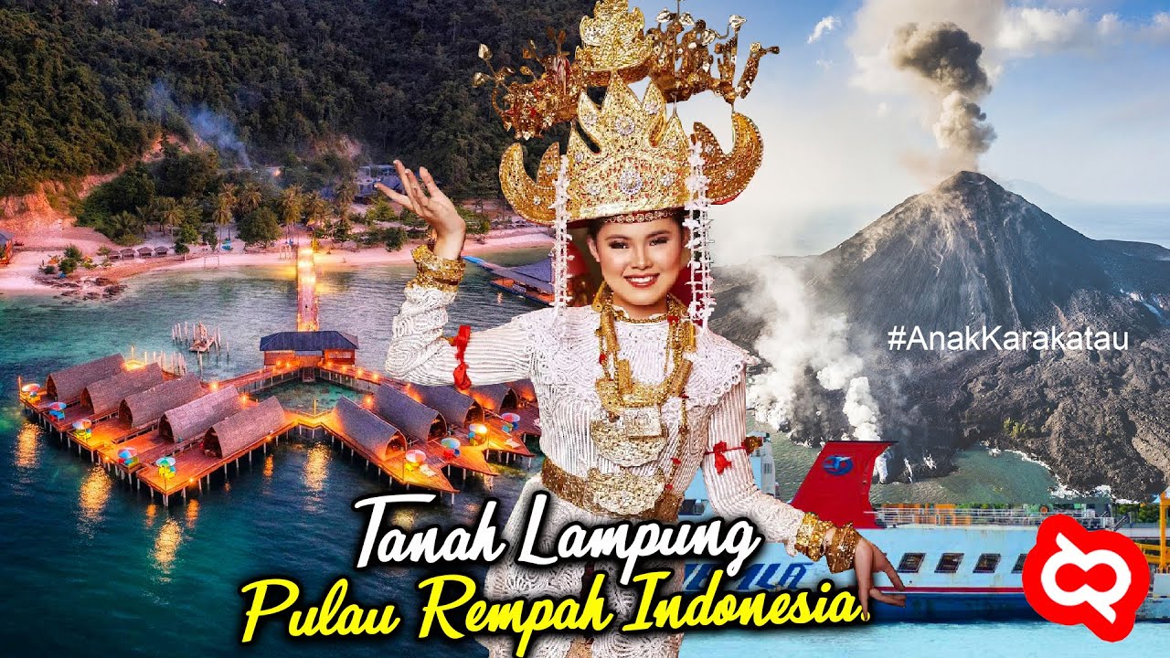
-Krakatau, also known as Rakata, is an active volcanic island located in the Sunda Strait between the islands of Java and Sumatra. Administratively, it falls within the district of Lampung Selatan, province of Lampung, Indonesia.
When was Krakatau declared a national park?
-Krakatau was declared a national park in 1980, and along with Ujung Kulon National Park, it was designated as a UNESCO World Heritage Site in 1991.
What are the four islands that make up the Krakatau archipelago?
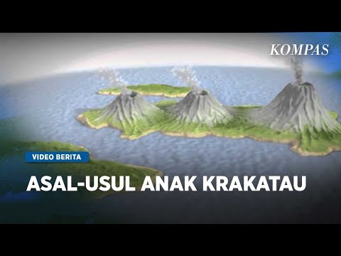
-The Krakatau archipelago consists of four islands: Pulau Sertung, Pulau Anak Krakatau, Pulau Rakata, and Pulau Panjang, which is sometimes also referred to as Pulau Rakata Kecil.
What was the significance of the 1883 eruption of Krakatau?
-The 1883 eruption of Krakatau was one of the deadliest and most destructive volcanic events in recorded history. It caused global climate changes, leading to cooler temperatures and reduced sunlight worldwide for years after the eruption.
How did the 1883 Krakatau eruption impact the global climate?
-The 1883 Krakatau eruption led to a significant drop in average summer temperatures in the Northern Hemisphere by about 0.4 degrees Celsius and caused the sun to appear dimmer for months due to the fine volcanic ash in the atmosphere.
What is the historical significance of the Krakatau eruption in terms of human population and technology?
-The Krakatau eruption in 1883 was the first natural disaster in history whose impact was truly felt worldwide, coinciding with the growth of telegraph and undersea cable communications, indicating the rapid development of information technology at the time.
What is the geological origin of the Krakatau islands?
-The Krakatau islands originated from a single volcanic system, the Krakatau volcano, which had a catastrophic eruption in the past. The current islands are remnants of this ancient volcano.
What is the historical record of the Krakatau 'pura' or ancient Krakatau eruption?
-The Krakatau 'pura' or ancient Krakatau is believed to have had a massive eruption around 535 CE, which created a large caldera known as the Krakatau 'pura'. This event may have contributed to a period of global cooling and cultural shifts.
How did the 1883 Krakatau eruption compare to other significant eruptions in history?
-While the 1883 Krakatau eruption was one of the largest in recorded history, it was not the largest. The eruptions of Mount Tambora in 1815 and the ancient eruption of Mount Samalas or Rinjani in 1257 were more powerful, recording a Volcanic Explosivity Index (VEI) of 7, compared to Krakatau's VEI of 6.
What is the largest volcanic eruption known to have occurred in the area that is now Indonesia?
-The largest known volcanic eruption in the area that is now Indonesia was the super-eruption of Mount Toba around 74,000 years ago, also known as the 'super eruption' of Toba. This event caused a severe global volcanic winter and significantly impacted human genetics.
What is the current status of the Krakatau volcano?
-Since the 1883 eruption, the Krakatau volcano has been relatively quiet until 1927 when a new volcanic cone, Anak Krakatau, emerged from the caldera. It has been active since, with over 100 eruptions recorded up to the year 2000.
Outlines
🌋 Krakatau: The Active Volcanic Island
Krakatau, also known as Rakata, is an active volcanic island located in the Sunda Strait between Java and Sumatra. Administratively, it falls within the district of Lampung, Indonesia. Declared a nature reserve in 1921, it was later proposed as a national park in 1980 and recognized as a UNESCO World Heritage Site in 1991. The Krakatau archipelago consists of four islands, including the infamous Rakata, which is the remnant of the Krakatau volcano system. The island is renowned for its catastrophic eruption in 1883, one of the deadliest and most destructive volcanic events in history, causing global climate changes and lowering temperatures worldwide. The eruption also resulted in a volcanic winter and was visible in the skies as far as Norway and New York, leading to the term 'Equatorial Smoke Stream' for the atmospheric effects.
🔥 The Devastating 1883 Eruption of Krakatau
The 1883 eruption of Krakatau was a monumental event that spanned from May to October, peaking on August 27th, when over 70% of the island was destroyed. The explosion was heard 3,110 km away and generated tsunamis that reached as far as Hawaii and the Arabian Peninsula, over 7,000 km away. The pressure wave from the eruption was recorded by barographs worldwide. The eruption released an estimated 200 megatons of energy, equivalent to 4 times the power of the largest nuclear bomb ever detonated. It ejected volcanic ash 80 km high and scattered pumice stones over 21 km³ into the atmosphere, causing darkness for days and leading to a significant drop in global temperatures. The official death toll was 36,417, but estimates suggest over 120,000 lives were lost. The eruption had a profound impact on the climate and was a pivotal moment in the history of global communication and technology, as it was one of the first natural disasters to be felt worldwide due to the advancement of telegraph and undersea cable networks.
🌿 Krakatau's Recovery and Ongoing Volcanic Activity
After the 1883 eruption, Krakatau was almost entirely destroyed, but by 1927, a new volcanic cone, Anak Krakatau (Child of Krakatau), emerged from the caldera. This new island has been active since its formation, with over 100 eruptions recorded by the year 2000. The island's growth and frequent eruptions have been a testament to the continuous volcanic activity in the region. The area around Krakatau is part of the Pacific Ring of Fire, a zone of intense seismic and volcanic activity due to the collision of the Indo-Australian and Eurasian tectonic plates. Indonesia, where Krakatau is located, has the highest number of active volcanoes in the world, highlighting its geological significance. The name 'Krakatau' is believed to be derived from the Sanskrit word for 'lobster' or 'crab,' reflecting its shape and the surrounding islands.
🏔️ Krakatau: A Historical and Geological Marvel
Krakatau's 1883 eruption is recorded as one of the largest volcanic eruptions in modern history, with a Volcanic Explosivity Index (VEI) of 6, indicating its immense scale. The eruption's impact was so profound that it was recorded in The Guinness Book of Records. Despite its magnitude, Krakatau's eruption was not the largest in the region; the 1851 eruption of Mount Tambora and the 1257 eruption of Mount Samalas (or Rinjani) were even more powerful, with a VEI of 7. The most significant eruption in the area, known as the Toba eruption around 74,000 years ago, had a VEI of 8 and caused a volcanic winter that lasted for 6 to 10 years, contributing to a millennium-long cooling period. The remnants of this eruption can still be seen in the form of Lake Toba in Sumatra. The video concludes with a brief overview of Krakatau's historical significance and its place within the geological context of Indonesia.
Mindmap
Keywords
💡Krakatau
💡Volcanic Eruption
💡Sunda Strait
💡UNESCO World Heritage Site
💡Volcanic Explosivity Index (VEI)
💡Climate Change
💡Tsunami
💡Catastrophe
💡Geological History
💡Cultural Impact
💡Rejuvenation
Highlights
Krakatau, also known as Rakata, is an active volcanic island located in the Sunda Strait between Java and Sumatra.
Administratively, Krakatau is part of the South Lampung Regency in the province of Lampung, Indonesia.
Krakatau was declared a nature reserve in 1921 and later proposed as a national park in 1980.
In 1991, the Ujung Kulon National Park and Krakatau nature reserve were designated as a UNESCO World Heritage Site.
The Krakatau archipelago consists of four islands: Sertung, Anak Krakatau, Rakata, and Panjang, also known as Krakatau Kecil.
Geological studies suggest that the Krakatau islands originated from a single volcanic system that existed in the past.
The 1883 eruption of Krakatau is recorded as one of the deadliest and most destructive volcanic events in history.
The eruption's impact caused global climate changes, leading to cooler temperatures and a 'volcanic winter'.
The Krakatau eruption was so massive that it darkened the skies worldwide for years and affected global weather patterns.
The eruption was heard as far as 3,110 km away, and the resulting tsunami waves reached as far as 7,000 km away.
The 1883 eruption released an estimated 200 megatons of energy, equivalent to 4 times the strength of the largest nuclear bomb ever detonated.
The eruption launched volcanic ash up to 80 km high and ejected approximately 21 km³ of rock fragments into the air.
The official death toll from the Krakatau eruption was recorded as 36,417, though other estimates suggest over 120,000 fatalities.
The Krakatau eruption had a significant impact on global climate, causing a drop in average summer temperatures in the Northern Hemisphere.
After the eruption, the area around Krakatau was almost entirely destroyed, with only a third of the southern part remaining.
In 1927, a new volcanic cone, Anak Krakatau, emerged from the caldera, and it has been erupting periodically since then.
Krakatau is part of the Pacific Ring of Fire, a region with significant volcanic and seismic activity due to the collision of tectonic plates.
The name 'Krakatau' is believed to be a misspelling by English press during the 1883 eruption, and it is also associated with the shape of a lobster or crab.
The 1883 Krakatau eruption is considered one of the largest volcanic eruptions in modern history, with a Volcanic Explosivity Index (VEI) of 6.
The Krakatau eruption was the first natural disaster in history to have a truly global impact, felt due to the development of telegraph and undersea cable communications.
Transcripts
rrakatao atau Rakata atau yang secara
internasional lebih dikenal dengan nama
krakatoa adalah sebuah kepulauan
vulkanik yang masih aktif yang terletak
di perairan selat Sunda antara pulau
Jawa dan
Sumatera secara administrasi krakataau
masuk ke dalam wilayah kabupaten lambung
selatan provinsi lambung
Indonesia
[Musik]
rrakatau dinyatakan sebagai cagar alam
pada tahun
1921 bersama dengan beberapa cagar alam
lainnya kawasan ini diusulkan sebagai
taman nasional pada tahun
1980 pada tahun
1991 Taman Nasional Ujung Kulon dan
cagar alam Krakatau ditetapkan sebagai
situs warisan dunia
UNESCO wilayah kepulauan Krakatau
sendiri terdiri dari empat pulau yaitu
pulau sertung pulau anak rakatau Pulau
Rakata dan pulau panjang atau yang
kadang disebut juga dengan pulau Rakata
kecil berdasarkan kajian geologi
pulau-pulau yang membentuk kepulauan
Krakatau ini berasal dari sistem gunung
berapi tunggal Krakatau yang pernah ada
di masa
lalu
Gunung Krakatau sendiri dikenal dunia
karena letusannya yang sangat dahsyat
yang terjadi pada pertengahan tahun
1883 letusan gunung krakato tersebut
tercatat menjadi salah satu peristiwa
gunung berapi yang paling mematikan dan
paling merusak dalam sejarah Hal ini
karena dampak yang ditimbulkan dari
letusan gunung tersebut mengakibatkan
perubahan iklim secara
[Musik]
global disebutkan bahwa efek dari letus
gunung tersebut telah menyebabkan musim
dingin
Vulkanik pada tahun setelah letusan suhu
rata-rata musim panas di belahan bumi
utara turun sebesar 0,4 derajat
Celcius letusan gunung krakatal tahun
1883 telah berhasil menggelapkan langit
di seluruh dunia selama bertahun-tahun
setelahnya dan menyebabkan matahari
bersinar redup di seluruh dunia selama
berbulan-bulan karena tertutup debu-debu
halus
vulkanik amburan debu halus ini bahkan
tampak di langit Norwegia hingga New
York William askov seorang seniman
Inggris telah membuat ribuan sketsa
warna matahari terbenam berwarna merah
di separuh dunia dari Krakatau pada
tahun-tahun setelah
letusan Jika dilihat dari efek
letusannya letusan gunung Krakatau ini
sebenarnya bisa dikatakan masih kalah
jika dibandingkan dengan letusan gunung
samalas atau gunung Rinjani tua gunung
ora dan juga Gunung
Toba namun gunung-gunung tersebut
meletus jauh pada masa ketika populasi
Manusia masih sangat sedikit sementara
itu ketika Gunung Krakatau meletus
populasi manusia sudah cukup padat sens
dan teknologi telah berkembang telegraf
sudah ditemukan dan kabel bawah laut
sudah dipasang dengan demikian dapat
dikatakan bahwa saat itu teknologi
informasi sedang tumbuh dan berkembang
dengan pesat
disebutkan bahwa letusan Krakatau
merupakan bencana alam pertama dalam
sejarah yang dampaknya benar-benar
terasa di seluruh dunia dan diketahui
penyebabnya menyusul berkembangnya kabel
komunikasi Lintas
[Musik]
[Musik]
Samudra ahli kirakan bahwa pada masa
purba terdapat gunung yang sangat besar
di Selat Sunda yang akhirnya meletus
Dahsyat yang menyisahkan sebuah kaldera
atau kawa besar yang disebut sebagai
gunung krakat purba Gunung Krakatau
purba ini disebut-sebut merupakan induk
dari gunung
Krakatau letusan Krakatau purba
diperkirakan terjadi pada tahun 535
masehi hal ini mungkin dapat ditafsirkan
dari kitab pedalangan pustaka raja
Purwa pakar geologi Baren Jos eer dan
beberapa ahli lainnya berpendapat bahwa
kejadian alam yang diceritakan dalam
kitab tersebut berasal dari gunung
Krakatau purba yang dalam teks disebut
sebagai gunung
batuara menurut pustaka raja Purwa
tinggi Krakatau purba ini mencapai 2000
m di atas permukaan laut dan lingkaran
pantainya mencapai 11
KM ledakan hebat itu telah menyebabkan
terbentuknya Selat Sunda serta hilangnya
peradaban pasemah Lampung dan Sala
negara Banten selama sekitar 20 hingga
30
tahun 3 perempat bagian gunung krakat
purba hancur menyisakan kaldera atau
kawah besar di Selat
Sunda sisi-sisi atau tepi kawahnya
dikenal sebagai Pulau Rakata pulau
sertung dan pulau panjang atau Rakata
kecil letusan gunung ini disinyalir
bertanggung jawab atas terjadinya tahun
kegelapan di muka
bumi
dalam buku catastropy and Investigation
into the Origin Of The Modern World yang
ditulis oleh David kiss pada tahun 2000
letusan gunung krakat purba dianggap
turut andil dalam berakhirnya masa
kejayaan Persia kuno transmutasi
kerajaan Romawi ke kerajaan Bizantium
berakhirnya peradaban Arab Selatan
punahnya kota besar Maya dan jatuhnya
peradaban nask di Amerika Selatan yang
penuh
teka-teki ledakan Krakatau purba
diperkirakan berlangsung selama 10 hari
dengan perkiraan kecepatan muntahan
massa mencapai 1 juta ton per detik
ledakan tersebut telah membentuk
perisaia atmosfer setebal 20 hingga 150
M dan menurunkan temperatur sebesar 5
sampai 10 derajat selama kurun waktu 10
hingga 30
tahun Pulau Rakata yang merupakan satu
dari tiga Pulau sisa Gunung Krakatau
purba yang kemudian tumbuh sesuai dengan
dorongan vulkanik dari dalam perut bumi
yang di enal sebagai Gunung Krakatau
atau gunung Rakata kemudian dua gunung
api muncul dari tengah kawah bernama
gunung Danan dan gunung perbuatan yang
kemudian menyatu dengan gunung Rakata
yang telah muncul terlebih
dahulu persatuan ketiga gunung api
inilah yang kemudian disebut sebagai
Gunung
[Musik]
Krakatau selama abad pertengahan yaitu
antara abad ke9 hingga abad ke-16
disebutkan bahwa Gunung Krakatau sempat
mengalami beberapa kali peristiwa
letusan peristiwa ini diperkirakan
terjadi pada tahun
850
950 1050
1150
1320 dan tahun
1530 namun peristiwa letusan gunung
Krakatau selama periode tersebut belum
dapat dikonfirmasi
sepenuhnya satu-satunya letusan yang
dikonfirmasi sebelum letusan besar tahun
1883
adalah letusan Sedang pada tahun
1680 pada tahun
1880 gunung perbuatan aktif mengeluarkan
lava Meskipun tidak
meletus setelah masa itu tidak ada lagi
aktivitas vulkanis di Krakatau hingga
tanggal 20 Mei tahun
1883 letusan gunung krakataau tahun 1883
di Selat Sunda terjadi dari tanggal 20
Mei hingga tanggal 21 Oktober tahun
1883 Puncak letusannya sendiri terjadi
pada tanggal 27 Agustus tahun
1883 ketika lebih dari 70% pulau
Krakatau dan kepulauan sekitarnya hancur
dan runtuh menjadi
kaldera letusan tersebut merupakan salah
satu peristiwa gunung berapi yang paling
mematikan dan paling merusak dalam
sejarah dentuman ledakannya bahkan
terdengar sejauh 3.110 KM di per austral
barat dan Rodriguez dekat mautius
sekitar 4800 KM
[Musik]
jauhnya gelombang tsunami yang
ditimbulkan bahkan merambat hingga ke
pantai Hawai pantai barat Amerika Tengah
dan semenanjung Arab yang jauhnya hingga
7.000
KM gelombang tekanan dari ledakan
tersebut tercatat pada barograf atau
alat pencatat tekanan barometrik di
seluruh dunia gelombang tersebut
mengelilingi bumi sebanyak 3,eng kali
dilaporkan bahwa suara letusan pada
tanggal 27 Agustus tersebut sangat keras
sehingga siapapun yang berada dalam
jarak 16 KM akan menjadi
tuli energi dilepaskan dari ledakan
tersebut diperkirakan setara dengan
sekitar 200 megaton TNT atau kira-kira
empat kali lebih kuat dari Sar Bomba
senjata termonuklir paling kuat yang
pernah
diledakkan ada pula yang menyebutkan
bahwa energi yang dilepaskan selama
Puncak erupsi tersebut mencapai 30.000
kali bom atom yang diledakkan di
Hiroshima dan Nagasaki pada perang dunia
kedua menjadikannya sebagai salah satu
ledakan paling dahsyat yang pernah
tercatat dalam sejarah
letusan ini melontarkan Material berupa
abu vulkanik setinggi 80 KM dan juga
memuntahkan sekitar 21 km³ pecahan
batuan ke udara di dekat gunung berapi
tumbukan batu apung yang mengapung
sangat tebal hingga mampu menghentikan
kapal wilayah sekitarnya gelap gulita
selama 2 Seteng hari karena Abu di
udara debu halus tersebut melayang
beberapa kali mengelilingi bumi
menyebabkan matahari terben sepanjang
tahun
berikutnya pengamat cuaca pada saat itu
melacak dan memetakan dampaknya terhadap
langit mereka menamakan fenomena
tersebut sebagai Equatorial smok
stream kombinasi aliran piroklastik atau
gas panas abu vulkanik dan tsunami yang
terkait dengan letusan Krakatau
menimbulkan dampak bencana regional dan
di seluruh
dunia beberapa lahan di Banten sekitar
80 KM bagian selatan tidak pernah
dihunik kembali wilayah tersebut
kemudian berubah menjadi hutan dan
sekarang menjadi Taman Nasional Ujung
Kulon jumlah resmi korban tewas akibat
letusan gunung berapi tersebut yang
dicatat oleh otoritas Belanda adalah
36.417 jiwa meskipun perkiraan lain
menyebutkan ada lebih dari 120.000
korban jiwa ada banyak laporan yang
terdokumentasi mengenai sekelompok
kerangka manusia yang mengambang
melintasi Samudra Hindia di atas batu
apung vulkanik dan terdampar di pantai
timur Afrika hingga 1 tahun setelah
letusan suhu musim panas di belahan bumi
utara turun rata-rata 0,4 derajat
Celcius pada tahun setelah letusan
setelah beberapa tahun setelah letusan
dilaporkan bahwa bulan tampak berwarna
biru dan terkadang hijau hal ini terjadi
karena beberapa awan Abu dipenuhi dengan
partikel dengan lebar sekitar 1
mikrome orang-orang juga melihat
matahari lavender dan untuk pertama
kalinya merekam fenomena awan noctilusen
yaitu fenomena awan yang bersinar di
malam
hari pasc letusan rrakatao diketahui
hampir seluruhnya hilang kecuali
sepertiga bagian
selatan mulai tahun
1927 atau kurang lebih 44 tahun setelah
meletusnya Gunung Krakatau muncul gunung
api yang dikenal sebagai anak rakatau
dari kawasan kaldera purba tersebut
sejak lahirnya anak rakatau hingga tahun
2000 gunung anak rakatau telah erupsi
lebih dari 100 kali baik bersifat
eksplosif maupun
evusif pada umumnya titik letusan selalu
berpindah-pindah di sekitar tubuh
kerucutnya banyaknya letusan membuat
gunung anak rakatau tumbuh semakin besar
dan tinggi membentuk rerucut yang
mencapai tinggi 300 m dari permukaan
laut sementara Gunung Krakatau
sebelumnya memiliki tinggi 813 m dari
permukaan laut Selain itu wilayah
daratan gunung baru ini pun semakin
meluas itulah tadi sedikit informasi dan
rangkuman sejarah tentang
Krakatau dan berikut adalah 10 fakta
menarik dari gunung
[Musik]
Krakatau krakat adalah salah satu dari
banyak gunung berapi yang terletak di
sepanjang Wilayah sekitar cekungan
Pasifik Tempat bertemunya dua lempeng
tektonik besar kedua lempeng ini yaitu
lempeng Indo Australia dan Eurasia terus
menerus bertabrakan sehingga
mengakibatkan banyak aktivitas vulkanik
daerah ini dikenal oleh para ahli
geologi sebagai cincin
api mayoritas gunung berapi ini terletak
di sepanjang Dua pulau terbesar di
Indonesia yaitu pulau Jawa dan
Sumatera
kedua Pulau ini dipisahkan oleh Selat
Sunda yang terletak pada suatu tikungan
pada sumbu busur Pulau Krakatau berada
tepat di atas zona subduksi lempeng
Eurasia dan lempeng Indo Australia di
mana batas lempengnya mengalami
perubahan arah yang tajam Yang
kemungkinan mengakibatkan Kak yang
sangat lemah di wilayah
[Musik]
tersebut sebagai salah satu negara yang
terletak di kawasan cincin api onesia
memiliki setidaknya 130 gunung berapi
aktif jumlahnya tersebut adalah yang
terbanyak di antara negara manaun di
dunia krakat secara global lebih dikenal
dengan nama krakatoa ejaan nama krakatoa
sendiri dipercaya secara luas sebagai
kesalahan pengetikan yang dilakukan oleh
pers Inggris ketika mereka melaporkan
letusan gunung tersebut pada tahun
1883
nama Krakatau tidak hanya mengacu pada
gunung berapi itu sendiri tetapi juga
gugusan pulau yang ditinggalinya
termasuk pulau induknya yang juga
dikenal dengan nama pulau
[Musik]
Rakata teori tentang asal-usul nama
krakataau dalam bahasa Indonesia sendiri
kemungkinan berasal diambil dari bahasa
Sansekerta dari kata karka atau karkata
atau karkataka yang berarti lobster atau
kepiting bentuk singkatan Rakata juga
berarti kepiting Dalam bahasa Jawa
[Musik]
kuno letusan gunung Krakatau pada tahun
1883 adalah salah satu letusan gunung
berapi terbesar dalam sejarah manusia
ini bahkan disebut-sebut sebagai letusan
gunung berapi terbesar dalam sejarah
modern menurut para peneliti di
University of North Dakota ledakan
krakata tahun
1883 mencatatkan skala magnitude 6 pada
indeks daya ledak vulkanik atau vulkanic
explosivity index atau yang disingkat
dengan vei indeks daya ledak Vulkanik
adalah ukuran relatif dari tingkat
Ledakan dari letusan gunung berapi dan
sejarah letusan indeks vei sendiri
memiliki nilai skala dari 0 hingga
[Musik]
8 The guness Book of Record kan letusan
gunung Krakatau pada tahun
1883 sebagai letusan gunung paling hebat
yang terekam dalam
[Musik]
sejarah seperti yang sudah disebutkan di
awal letusan gunung Krakatau tahun
1883 bukanlah satu-satunya letusan
gunung berapi terbesar yang pernah
terjadi di wilayah Indonesia saat ini
skalala letusannya bahkan masih berada
di bawah letusan Gunung Tambora pada
tahun 185
dan letusan gunung samalas atau Rinjani
tua pada tahun
1257 di mana keduanya mencatatkan skala
vei 7 pada indeks daya ledak
[Musik]
vulkanik sementara itu letusan gunung
paling besar yang pernah terjadi di
wilayah yang saat ini menjadi Indonesia
adalah letusan gunung berapi supervulkan
yang terjadi sekitar 74.000 tahun yang
lalu yang lebih dikenal dengan letusan
Gunung Toba atau kadang disebut super
erupsi Toba ini adalah salah satu
letusan eksplosif terbesar yang
diketahui dalam sejarah bumi teori
bencana Toba menyatakan bahwa peristiwa
ini menyebabkan musim dingin vulkanik
Global yang parah selama 6 hingga 10
tahun dan berkontribusi terhadap episode
pendinginan selama 1000 tahun yang
disebut turut menyebabkan hambatan
genetik pada
manusia dalam indeks daya ledak vulkanik
letusan Gunung Toba mencatatkan skala
vi8 sisa-sisa letusannya masih bisa kita
jumpai hingga saat ini di wilayah
provinsi sumatraa Utara yang lebih kita
kenal dengan Danau
[Musik]
Toba itulah tadi sedikit informasi
rangkuman Sejarah dan beberapa fakta
menarik tentang Gunung
Krakatau Terima kasih sudah menonton dan
tunggu video dari kami selanjutnya
[Musik]
تصفح المزيد من مقاطع الفيديو ذات الصلة
Letusannya Hampir Bikin Manusia Punah? Penyebab Zaman Es? Erupsi Gunung Toba! | Learning By Googling
Letusan Terkeras Yang Pernah Terdengar! Lebih Dari Bom Hiroshima! Krakatau 1883 | LearningByGoogling
Year 536 Was the Worst Year to Be Alive - What Happened?
What Happens if a Supervolcano Blows Up?
Get Out NOW! Italy is about EXPLODE and millions will die! Why are they ignoring it? | Redacted
Meteorologist explains how volcanic eruptions affect the climate
5.0 / 5 (0 votes)