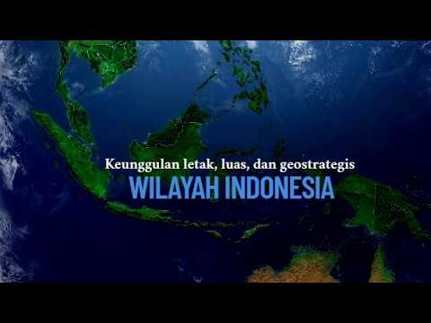
IPS Kelas 7 BAB 1 - Letak dan Luas Keunggulan Wilayah Indonesia
Summary
TLDRThe script discusses Indonesia's geographical significance, spanning from 6°N to 11°S latitude and 95°E to 141°E longitude. It lies between Asia and Australia, bordered by the Indian and Pacific Oceans, and neighboring countries like Malaysia, Singapore, the Philippines, and Australia. Indonesia's vast area of 5,193,992 km², including 1,990,440 km² of land across 17,508 islands, offers economic benefits year-round due to its fertile soil and diverse marine life. Its geological location, crossed by major mountain ranges and tectonic plates, contributes to its rich volcanic soil and mineral resources. The script also highlights Indonesia's strategic position for trade and potential negative impacts of its geography.
Takeaways
- 🌍 Indonesia is located between 6° North to 11° South latitude and 95° East to 141° East longitude, astronomically.
- 🗺️ Geographically, Indonesia is situated between the continents of Asia and Australia, bordered by the Indian Ocean to the west and the Pacific Ocean to the east.
- 🏖️ Indonesia shares land borders with Malaysia, Singapore, and the Philippines to the north, and borders Australia to the south.
- 🏝️ Comprising 17,508 islands, Indonesia has a vast land area of 1,904,440 km² and a maritime area of approximately 3,217,511 km².
- 🌱 The high rainfall in Indonesia contributes to its fertile soil, allowing for year-round economic activities.
- 🌬️ Indonesia experiences two distinct seasons due to monsoon winds: a dry season and a rainy season.
- 🚢 Strategically located at the crossroads between Asia and Australia, Indonesia serves as a transit point for maritime traffic between continents.
- 🌋 Geologically, Indonesia is crossed by major mountain ranges and tectonic plates, including the Indo-Australian and Pacific plates, and is home to numerous active volcanoes.
- 💎 The volcanic activity in Indonesia enriches the soil with volcanic ash, contributing to its fertility, and provides the country with abundant minerals and natural resources.
- 🌊 Indonesia's extensive coastline and marine resources offer a rich diversity of marine life, oil, and other resources.
Q & A
What is the astronomical location of Indonesia?
-Indonesia's astronomical location is between 6° North to 11° South latitude and 95° East to 141° East longitude.
How is Indonesia geographically positioned between continents and oceans?
-Indonesia is situated between the continents of Asia and Australia, and is bordered by the Indian Ocean to the west and the Pacific Ocean to the east.
Which countries share borders with Indonesia?
-Indonesia shares borders with Malaysia, Singapore, and the Philippines to the north, and with Australia to the south. It is also bordered by the Indian Ocean to the west and has maritime borders with Papua New Guinea to the east.
What is the total land area of Indonesia?
-The total land area of Indonesia is approximately 1,904,440 km2, consisting of 17,508 islands.
What is the total maritime area of Indonesia?
-The maritime area of Indonesia is about 3,217,511 km2, with a sea boundary of 12 miles and an exclusive economic zone of 200 nautical miles.
What are the geological features that influence Indonesia's location?
-Indonesia is crossed by two major volcanic arcs, the Mediterranean and the Pacific, and is situated on two tectonic plates, the Indo-Australian and the Pacific Plate. It is also crossed by three deep basins: the Sunda Basin, the Sahul Shelf, and the basin between Australia and Asia.
What are the advantages Indonesia gains from its astronomical location?
-Indonesia's astronomical location influences it with monsoon winds, resulting in two distinct seasons: the dry season and the rainy season. This leads to fertile land and allows for year-round economic activities.
How does Indonesia's geographical location contribute to its economic and strategic advantages?
-Indonesia's geographical location at the crossroads between Asia and Australia, and between the Indian and Pacific Oceans, allows it to establish communication with countries across continents and serves as a transit point for ships traveling between continents.
What are the advantages Indonesia gains from its geological location?
-Indonesia's geological location, being crossed by several active volcanoes, provides it with volcanic ash that enriches the soil. Additionally, it is rich in minerals and natural resources such as oil and gas.
What are some of the potential negative impacts of Indonesia's geographical location?
-The script suggests that while Indonesia's geographical location offers many advantages, it also implies potential negative impacts, such as natural disasters like volcanic eruptions and earthquakes due to its location on tectonic plate boundaries.
How does Indonesia's strategic geographical position affect global trade?
-Indonesia's strategic location serves as a trade route between East Asian countries and those in Europe, Africa, and the Middle East, which can have both positive economic impacts and potential challenges related to security and environmental concerns.
Outlines
🌍 Geographical Overview of Indonesia
This paragraph introduces the geographical location of Indonesia, highlighting its position between the equator and the Tropic of Capricorn, and between 95 and 141 degrees east longitude. It emphasizes Indonesia's location between the continents of Asia and Australia, bordered by the Indian Ocean to the west and the Pacific Ocean to the east. The country is also bordered by Malaysia, Singapore, and the Philippines to the north, and Australia to the south. The paragraph discusses Indonesia's geographical span, which includes 17,508 islands, and its territorial sea and exclusive economic zone. The video script also touches on the geological location, mentioning that Indonesia is crossed by significant geological features such as the Mediterranean and Pacific circum-Pacific volcanic belts, the Indo-Australian and Pacific tectonic plates, and the Sunda and Sahul shelves.
🌱 Advantages of Indonesia's Location
The second paragraph delves into the advantages that Indonesia's geographical, astronomical, and geological locations provide. Astronomically, Indonesia benefits from the monsoon winds, leading to a climate with two distinct seasons: dry and wet, which results in fertile soil conducive to year-round economic activities. Geographically, Indonesia's strategic position at the crossroads between Asia and Australia and its coastal length contribute to a diverse marine life, including a variety of fish species, coral reefs, and potential for oil and mineral resources. The paragraph also mentions Indonesia's rich volcanic soil and its geological advantages, such as being crossed by several active volcanoes and having abundant natural resources. The script concludes with a call to action for students to reflect on the day's learning and to identify any negative impacts of Indonesia's geographical location.
Mindmap
Keywords
💡Astronomical Location
💡Geographical Location
💡Latitude and Longitude
💡Archipelago
💡Monsoonal Winds
💡Fertile Soil
💡Volcanic Ash
💡Exclusive Economic Zone (EEZ)
💡Strategic Location
💡Geological Location
💡Natural Resources
Highlights
Indonesia is located between 6° North to 11° South latitude and 95° East to 141° East longitude.
Geographically, Indonesia is situated between Asia and Australia, bordered by the Indian and Pacific Oceans.
Indonesia shares borders with Malaysia, Singapore, the Philippines to the north, and Australia to the south.
The country is composed of 17,508 islands with a total land area of approximately 1,940,000 square kilometers.
Indonesia's maritime area is about 3,217,511 square kilometers with a 12-mile territorial sea limit and a 200-mile exclusive economic zone.
Geologically, Indonesia is crossed by two major mountain ranges, the Mediterranean and the Pacific Ring of Fire.
The country lies on two tectonic plates, the Indo-Australian and the Pacific Plate.
Indonesia's location provides advantages such as being influenced by monsoon winds, leading to two distinct seasons: dry and rainy.
The high rainfall makes Indonesian soil very fertile, supporting year-round economic activities.
Indonesia's geographical position at the crossroads between Asia and Australia, and the Indian and Pacific Oceans, is strategically advantageous for communication and trade.
The country's extensive coastline contributes to a diverse marine life, including various fish species and coral reefs.
Indonesia's geological activity, with numerous active volcanoes, enriches the soil with volcanic ash, making it more fertile.
The country is rich in minerals and natural resources such as oil and gas.
Indonesia's vast marine areas and tourist attractions are popular destinations for visitors.
Students are encouraged to identify any negative impacts of Indonesia's geographical location.
Reflect on the learning materials and identify any confusing points or key takeaways from the lesson.
Complete the LPTL (Learning Progress Tracking List) by writing down and confirming the learning points with teachers in school.
Transcripts
hai hai
Hai Bollywood tentang tetap paten pulang
wilayah Indonesia buku yang ternama yang
tujuan pembelajaran adalah kita dapat
mengidentifikasi letak wilayah Indonesia
yang ketiga siswa dapat adik-adik
tahukah kalian bagaimana letak wilayah
Indonesia Seberapa luas wilayah
Indonesia dan keunggulan apa yang
didapatkan dari wilayah Indonesia
tersebut Apa kalian sudah tahu
Apa yang dimaksud dengan letak wilayah
Indonesia secara Astronomi Yuk kita
bahas bersama letak wilayah Indonesia
secara astronomis adalah Letak suatu
wilayah yang dilihat dari garis lintang
dan garis bujur lalu Dimanakah letak
wilayah Indonesia secara garis
astronomis kembali perhatikan peta
berikut ini
Hai letak wilayah Indonesia secara
astronomis terletak diantara 6° lintang
utara sampai 11° lintang selatan dan 95
derajat bujur timur sampai 141 bujur
timur kita lanjutkan letak geografis
Indonesia perhatikan peta berikut ini
Hai nah Bagaimanakah dengan letak
geografis Indonesia oke letak geografis
suatu wilayah adalah letak wilayah yang
dilihat dari permukaan di muka bumi lalu
Dimanakah letak wilayah Indonesia secara
geografis nah Indonesia secara geografis
terletak diantara dua benua yaitu benua
Asia dan Benua Australia kemudian diapit
juga oleh dua samudra yaitu samudra
Hindia dan Samudra Pasifik
di Indonesia secara geografis juga
dibatasi oleh beberapa negara di
wilayahnya yang pertama Indonesia di
sebelah utara berbatasan dengan Malaysia
Singapura dan Filipina di Selatan
Indonesia berbatasan dengan Australia di
sebelah barat Indonesia berbatasan
dengan samudra Hindia sedangkan di
wilayah Timur Indonesia berbatasan
dengan Papua Nugini selanjutnya tahukah
kalian Bagaimana luas wilayah Indonesia
baik kita bahas bersama Indonesia
merupakan salah satu negara yang terluas
di muka bumi ini dengan luas negaranya
5193992 km2
di luar sini mencakup luas daratan dan
luar lautan luas daratan Indonesia
adalah 1990000 440 km2 terdiri dari
17508 pulau banyak ya pulau-pulau di
Indonesia Tuliskan Indonesia juga
terbentang sepanjang 3977 Mi dengan luas
lautan sekitar 3217511 km2 lautan
Indonesia memiliki batas 12 mil bingung
laut serta zona ekonomi eksklusif 200
news
Hai baik kita lanjut pada letak geologis
tahukah kalian Apa yang dimaksud dengan
letak geologis baik letak geologis
adalah Letak suatu wilayah yang dilihat
dari struktur batuannya yang menyusun
dipermukaan bumi lalu Dimanakah letak
geologis Indonesia perhatikan peta
berikut ini lagi
letak wilayah Indonesia secara geologis
yang pertama Indonesia dilalui oleh dua
sirkum pegunungan besar yaitu sirkum
Khan Mediterania dan sirkum pasifik yang
kedua Indonesia dilalui oleh dua
lempengan yaitu lempeng indo-australia
dan lempeng Pasifik yang ketiga
Indonesia juga dilalui oleh tiga
dangkalan yaitu dan kalian Sunda
dangkalan Sahul dan dan kalian laut
antara Australia dan Asia baik kita
masuk dalam pembahasan yang kedua
tentang keunggulan letak wilayah
Indonesia
Hai Bagaimanakah keunggulan yang
didapatkan Indonesia dari letak
astronomis geografis dan geologis Oke
kita bahas satu persatu silahkan
perhatikan peta berikut ini lagi letak
Indonesia secara astronomis mendapatkan
keunggulan yaitu Indonesia yang
dipengaruhi oleh angin muson sehingga
menyebabkan Indonesia mengalami dua
musim yaitu musim kemarau dan musim
hujan selanjutnya
hujan yang tinggi di Indonesia
menyebabkan
di tanah di Indonesia sangat subur dan
pergantian Putin periode enam bulan
sekali menyebabkan masyarakat Indonesia
dapat melakukan aktivitas ekonomi
sepanjang tahun
Hai yang kedua Bagaimanakah dengan
keunggulan Indonesia secara geografi
baik keunggulan Indonesia secara
geografis yang pertama Indonesia berada
di posisi tiok di posisi silang yang
sangat menguntungkan yaitu tadi Antara
Benua Asia dengan Benua Australia
Samudra Hindia dan Samudra Pasifik yang
menyebabkan Indonesia dapat menjalin
hubungan komunikasi dengan negara negara
diseluruh benua bahkan Indonesia menjadi
transit bagi kapal-kapal yang berlayar
yang menuju dari benua satu ke benua
lainnya selanjutnya Indonesia secara
geografis juga berada di garis pantai
yang panjang yang membuat sapi laut di
Indonesia ini sangat beragam sekali baik
dari jenis ikan yang beranekaragam
Karang
Hai minyak bumi dan lain sebagainya
Hai selanjutnya Bagaimanakah keunggulan
Indonesia secara geologis baik yang
pertama Indonesia karena dilalui oleh
beberapa gunung api yang masih aktif
menyebabkan adanya abu vulkanik yang
menyebabkan tanah di Indonesia menjadi
lebih subur yang kedua kayaknya
Indonesia dengan bahan-bahan tambang dan
mineral
Hai yang selanjutnya Indonesia juga kaya
akan lautan dan tempat-tempat wisata
yang biasa dikunjungi oleh berbagai
wisatawan Baiklah adik-adik silahkan
kalian untuk mengerjakan lptl KPD
berikut ini
Hai lkpd berikut ini nanti akan kalian
kerjakan silakan kalian tulis di buku
tulis kalian dan kalian konfirmasi
kepada guru kalian masing-masing di
sekolah
Hai untuk pembelajaran hari ini Mari
kita lakukan refleksi
Hai adakah dari materi yang Ibu
sampaikan tadi yang masih membingungkan
Hai kemudian Materi apa saja atau hal
apa saja yang sudah kalian dapatkan
dalam video pembelajaran hari ini
Hai bayi hilangkan kalian Tuliskan dan
kumpulkan bersama lkpd yang Ibu
sampaikan tadi di awal Selanjutnya
silakan kalian untuk mengamati tulisan
berikut ini
Hai letak Indonesia secara geografis
sangat strategis karena menjadi jalur
lalu lintas perdagangan dunia antara
negara-negara Asia Timur dan
negara-negara di Eropa Afrika dan Timur
Tengah dan India kondisi ini tidak
menutup kemungkinan adanya juga pengaruh
negatif yang ditimbulkan nah adik-adik
dapatkah kalian mengidentifikasi
pengaruh negatif dari letak geografis
Indonesia di
hai hai
تصفح المزيد من مقاطع الفيديو ذات الصلة
ruangbelajar - Geografi VII SMP - Kondisi Geografis Indonesia | bimbel online
Letak Geologis Indonesia
LETAK GEOGRAFIS | ASTRONOMIS INDONESIA DAN PENGARUHNYA, PENGERTIAN GARIS BUJUR DAN GARIS LINTANG
Mengenal Lokasi Tempat Tinggal
Letak Geografis Indonesia yang Terbaik Namun Juga Mengerikan
Potensi Pertambangan Indonesia #kumer
5.0 / 5 (0 votes)