Araling Panlipunan 8 MATATAG Q1 Week 1-1 Ang mga Kontinente ng Daigdig MATATAG with PPT and DLL
Summary
TLDRThis video script provides an educational overview of the continents and Southeast Asia. It begins by introducing Southeast Asia's countries and capitals, highlighting their cultural and historical significance. It then explores the world's continents, detailing their unique characteristics and borders, followed by a discussion on oceans. The script also includes a segment on notable landmarks across continents, with a focus on their symbolic importance. Finally, it emphasizes the value of geographical knowledge in understanding global relationships and history, encouraging further exploration and learning.
Takeaways
- 😀 The countries of Southeast Asia play a crucial role in understanding their culture, history, and relationship with the Philippines.
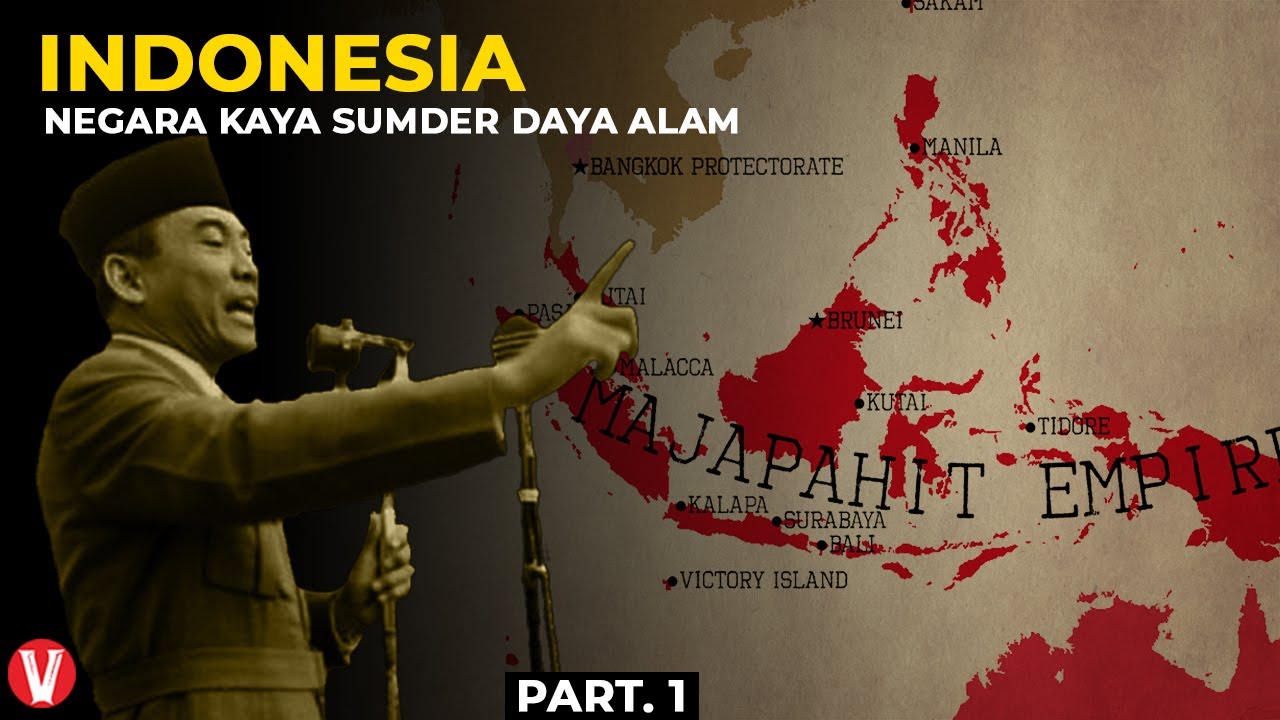
- 😀 Southeast Asia consists of countries like Thailand, Myanmar, Indonesia, Singapore, Malaysia, Vietnam, Timor Leste, Cambodia, Brunei, Laos, and the Philippines, each with their capitals.
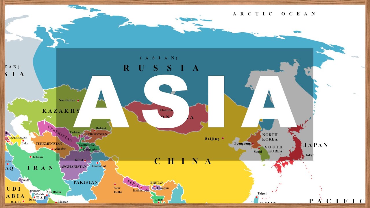
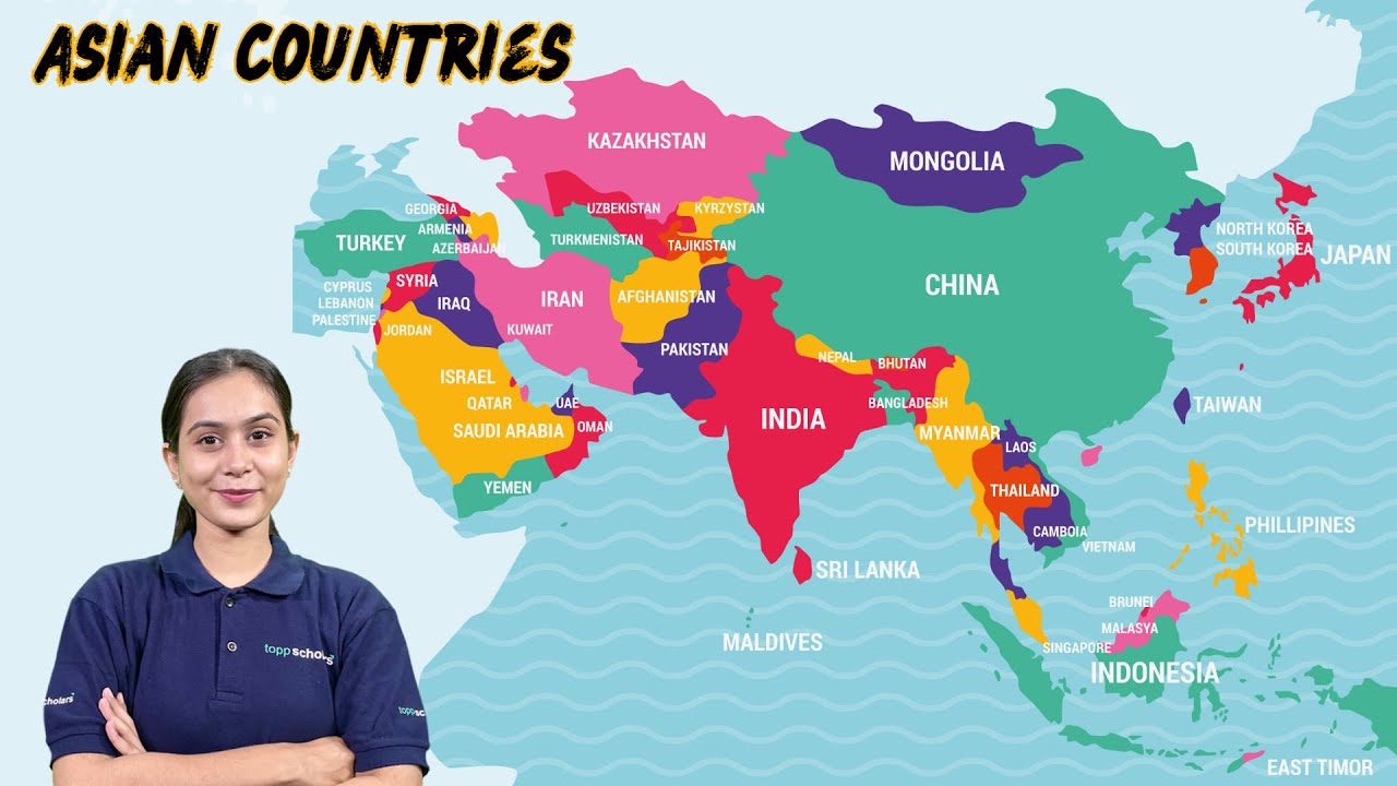
- 😀 Asia is the largest continent in both size and population, bordered by the Arctic Ocean, Red Sea, Ural Mountains, Indian Ocean, and Pacific Ocean.
- 😀 Africa is the second-largest continent, known for its vast supply of gold and diamonds, bordered by the Mediterranean Sea, Atlantic Ocean, and Indian Ocean.
- 😀 North America, with a triangular shape, is bordered by the Arctic Ocean, Pacific Ocean, Gulf of Mexico, and Atlantic Ocean.
- 😀 South America is shaped like a triangle, bordered by North America, the Pacific Ocean, the Southern Ocean, and the Atlantic Ocean.
- 😀 Antarctica is the fifth-largest continent, covered in ice and home only to scientists conducting research, with rich marine life around it.
- 😀 Europe is the second smallest continent and the third most populous, bordered by the Arctic Ocean, Atlantic Ocean, Mediterranean Sea, and Ural Mountains.
- 😀 Australia (Oceania) is the smallest continent, bordered by Indonesia, the Indian Ocean, Southern Ocean, and Pacific Ocean.
- 😀 The seven continents—Asia, Africa, North America, South America, Antarctica, Europe, and Australia—are surrounded by oceans like the Pacific, Atlantic, Indian, Southern, and Arctic Oceans, shaping global geography.
- 😀 Understanding the continents and oceans is essential for grasping global geography, relationships, and the historical importance of places, like the Great Wall of China, Christ the Redeemer, and the Statue of Liberty.
Q & A
What is the importance of studying the countries of Southeast Asia?
-Studying the countries of Southeast Asia is crucial for understanding their culture, history, and relationships with the Philippines.
Can you name the countries in Southeast Asia and their capitals?
-The countries in Southeast Asia and their capitals are: Thailand - Bangkok, Myanmar - Naypyidaw, Indonesia - Jakarta, Singapore - Singapore, Malaysia - Kuala Lumpur, Vietnam - Hanoi, Timor Leste (East Timor) - Dili, Cambodia - Phnom Penh, Brunei Darussalam - Bandar Seri Begawan, Laos (Lao PDR) - Vientiane, and the Philippines - Manila.
What is the significance of understanding the continents and oceans of the world?
-Understanding the continents and oceans is important because it provides a clear guide to the location of countries and regions, which is essential for analyzing their roles in history and global interactions.
What are the five regions of Asia?
-The five regions of Asia are: East Asia, Southeast Asia, South Asia, Central Asia, and West Asia.
What are the borders of Asia?
-Asia's northern border is the Arctic Ocean, its western border is the Red Sea and the Ural Mountains, its southern border is the Indian Ocean, and its eastern border is the Pacific Ocean.
How does Africa compare to Asia in terms of size and population?
-Africa is the second largest continent in the world, both in terms of size and population. It is also the source of a large supply of gold and diamonds.
Which continent is the smallest and what are its borders?
-Australia (or Oceania) is the smallest continent in the world. Its northern border is with Indonesia, its western border is the Indian Ocean, its southern border is the Southern Ocean, and its eastern border is the Pacific Ocean.
What are the major oceans that border continents?
-The major oceans that border continents are the Pacific Ocean, Atlantic Ocean, Indian Ocean, Southern Ocean, and Arctic Ocean.
Why is it important to know about the world's oceans?
-Knowledge of the world's oceans is important because they provide livelihoods for people, support global trade, and are rich in resources like fish and mammals.
Which continent is home to the Great Wall of China?
-The Great Wall of China is located in Asia.
Outlines

This section is available to paid users only. Please upgrade to access this part.
Upgrade NowMindmap

This section is available to paid users only. Please upgrade to access this part.
Upgrade NowKeywords

This section is available to paid users only. Please upgrade to access this part.
Upgrade NowHighlights

This section is available to paid users only. Please upgrade to access this part.
Upgrade NowTranscripts

This section is available to paid users only. Please upgrade to access this part.
Upgrade NowBrowse More Related Video
Map of Asia: Countries, National Flags, Capitals (with Photos). Learn Geography #02

BENUA DAN SAMUDERA |PROSES TERBENTUKNYA BENUA & SAMUDERA|

Mengenal ASEAN dan Karakteristik Negara Anggota ASEAN

Materi IPS Kelas 9 Bab 1: Letak dan Luas Benua Di Dunia
Menuju Kemajuan! Inilah Negara Indonesia
Discover the Geography of Asia: Exploring Asian Countries and Their Map #geography #asiancountries
5.0 / 5 (0 votes)