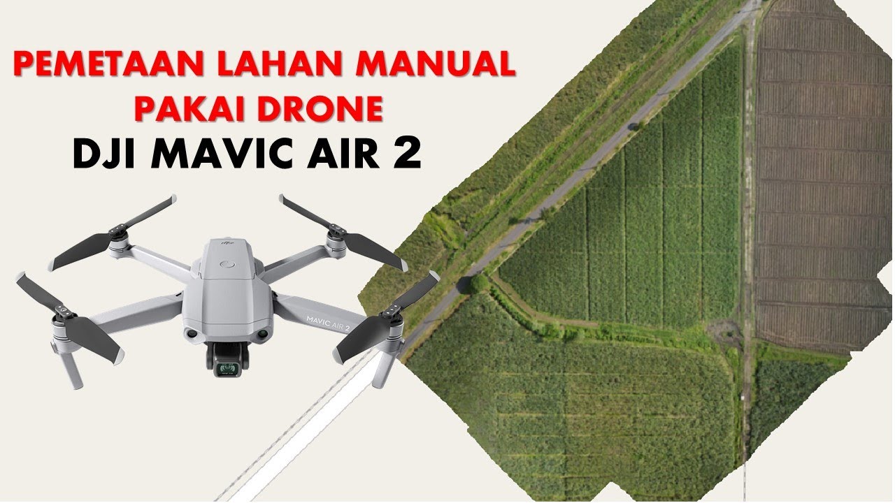
Tutorial Maping Menggunakan Mavic Air 2 Dengan Aplikasi Dronedeploy
Summary
TLDRIn this video, the creator shares insights on mapping using a DJI Mavic 2 drone with the DroneDeploy app. They explain the basic principles of drone mapping, equipment needed, and the software involved. The process includes setting up flight paths, choosing appropriate settings, and capturing aerial images to create scaled maps. The video also touches on the importance of using a powerful laptop and dealing with obstacles during the mapping process. Finally, the creator recommends the Mavic 2 for mapping tasks, especially for those looking for a professional but accessible drone solution.
Takeaways
- 😀 The DJI Mavic 2 is the drone of choice for mapping in 2022, as it supports mapping applications like DroneDeploy.
- 😀 Mapping involves creating scaled aerial images that can be measured, such as a 1:100 scale where 1 cm equals 100 meters.
- 😀 To perform mapping, drones take images piece by piece while flying horizontally, with the camera pointing downward.
- 😀 Essential tools for mapping include a capable drone, a laptop/PC with high specifications, and proper software like DroneDeploy.
- 😀 When mapping large areas (e.g., 100 hectares), using a powerful laptop or PC is crucial to avoid slow processing times.
- 😀 Mapping projects can take a long time depending on the area size, requiring patience and a system with strong processing power.
- 😀 DroneDeploy is an easy-to-use mapping app where users can plan flight paths, set project names, and adjust various parameters like flight altitude.
- 😀 The app allows for creating and editing flight routes using a Google Maps interface to mark the project area and estimate the total size (e.g., hectares).
- 😀 The drone’s flight height, speed, camera orientation, and other parameters can be adjusted to ensure optimal mapping conditions.
- 😀 While mapping large areas, it’s important to monitor the drone’s status to avoid issues like loss of signal or battery depletion, which may cause it to return home (RTH).
Q & A
What drone is used for mapping in this video?
-The DJI Mavic 2 is used for mapping in the video. The presenter specifically mentions that it is their preferred drone in 2022.
What is the key feature of the Mavic 2 that makes it suitable for mapping?
-The Mavic 2 is suitable for mapping because it can perform mapping using the DroneDeploy application, which is one of the mapping tools discussed in the video.
What other mapping applications were mentioned in the video?
-Besides DroneDeploy, the presenter mentions other mapping applications such as DJI Go 4 and Pix4D. However, Pix4D does not support the DJI Mavic 2, so the presenter uses DroneDeploy.
What is the basic concept of mapping using drones as explained in the video?
-Mapping using drones involves capturing aerial images of an area to create a scaled map. The map can be used to measure distances, such as a 1:100 scale, meaning 1 cm on the map represents 100 meters in reality.
How should one prepare for mapping using drones?
-To prepare for mapping, one needs a suitable drone (such as the DJI Mavic 2), a powerful laptop or PC with sufficient specs, and a mapping application like DroneDeploy. The laptop should be powerful enough, especially for large-scale mapping projects.
What considerations should be made when selecting a laptop for drone mapping?
-When selecting a laptop for drone mapping, it is crucial to choose one with high specifications. The presenter emphasizes that for mapping large areas (such as over 100 hectares), a powerful laptop is necessary to avoid long processing times.
What is the significance of DroneDeploy in the mapping process?
-DroneDeploy is highlighted as an easy-to-use application for creating maps. The video demonstrates how to set up a mapping project in DroneDeploy, including selecting the area, altitude, and flight path to capture aerial images.
What are the steps to set up a mapping flight in DroneDeploy?
-To set up a mapping flight in DroneDeploy, the user creates a new project, defines the area of interest using Google Maps, adjusts the flight altitude (e.g., 100 meters), and sets parameters like overlap (80%) for the images. After finalizing the settings, the flight plan can be launched.
What precautions should be taken when flying a drone for mapping?
-When flying a drone for mapping, it’s important to ensure the drone maintains a stable GPS connection and avoid obstacles such as trees or power lines. If the signal is lost or the battery runs low, the drone will automatically return to its starting point (RTH).
What drone models are recommended for mapping?
-The presenter recommends the DJI Mavic 2 Pro or Mavic 2 S as the best drones for mapping, particularly for those seeking a good balance between cost and performance. These drones are considered ideal for mapping tasks without being too high-end.
Outlines

This section is available to paid users only. Please upgrade to access this part.
Upgrade NowMindmap

This section is available to paid users only. Please upgrade to access this part.
Upgrade NowKeywords

This section is available to paid users only. Please upgrade to access this part.
Upgrade NowHighlights

This section is available to paid users only. Please upgrade to access this part.
Upgrade NowTranscripts

This section is available to paid users only. Please upgrade to access this part.
Upgrade NowBrowse More Related Video
Cara Mapping Lahan dengan Drone MANUAL tanpa aplikasi MAPPING
My Vlogging Gear - Why I am NOT Using GoPro 🎬
7 MORE DJI Pocket 3 Tips and Tricks

Mavic 2 Enterprise Advanced Thermal Drone - Start Your Own Commercial Drone Business!

Dji MAVIC 4 Pro BEFORE OFFICIAL LAUNCH! IT COSTS YOU €3,600 TO FLY. BETTER? Find out NOW!

DJI Air 3S - Does it beat the Mavic 3?
5.0 / 5 (0 votes)