Tema 1. Parte 1. Base Cartográfica
Summary
TLDRIn this video, the speaker, Engineer Hibernando Ureña, introduces the fundamentals of cartography. The session covers the definition of cartography as the science of map-making, highlighting key elements that every map must include: title, scale, coordinates, legend, orientation, and data sources. The process of creating a map is explored, emphasizing the importance of planning, prototyping, and revising the map for clarity and accuracy. The speaker also addresses the importance of simplicity in design and the need for maps to meet institutional standards for evaluation. This video serves as an essential guide for those interested in understanding and creating maps.
Takeaways
- 😀 Cartography is the science that studies the creation and design of maps, including geographical and topographical maps.
- 😀 A map is a graphic representation of part of the Earth's surface on a flat surface (usually paper).
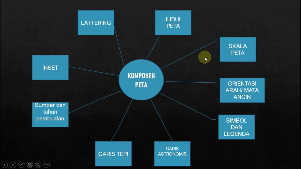
- 😀 The title of a map is crucial, as it indicates the map's purpose and what it intends to show.
- 😀 Important elements of a map include the title, location details, scale, coordinates, legend, orientation, and sources.
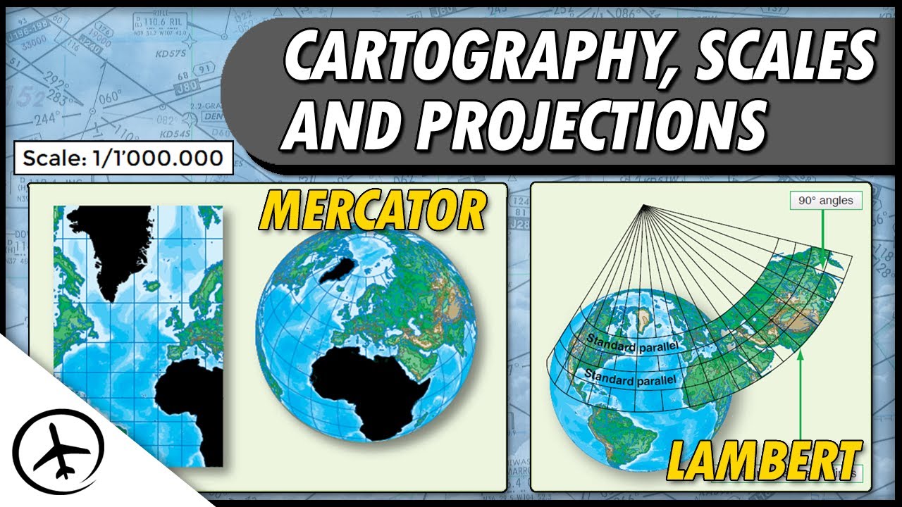
- 😀 The scale of a map can be numeric, graphical, or equivalent, and it helps to understand the relationship between the map's representation and the real-world distances.
- 😀 The coordinates system and geodetic datum are essential for accurately positioning and creating a map.
- 😀 A map's legend explains the symbols used, which may represent points, lines, or polygons.
- 😀 Toponymy refers to the style and size of lettering used in a map, such as italics or bold to differentiate names or locations.
- 😀 The orientation of a map shows the direction, typically north, but it can be adjusted for space or design purposes.
- 😀 The sources section of a map details the origin of the data used, similar to bibliographies in academic reports.
- 😀 Institutions like the Forest and Land Authority may evaluate a map's accuracy and completeness based on predefined criteria, including scale, location accuracy, and boundaries.
Outlines

This section is available to paid users only. Please upgrade to access this part.
Upgrade NowMindmap

This section is available to paid users only. Please upgrade to access this part.
Upgrade NowKeywords

This section is available to paid users only. Please upgrade to access this part.
Upgrade NowHighlights

This section is available to paid users only. Please upgrade to access this part.
Upgrade NowTranscripts

This section is available to paid users only. Please upgrade to access this part.
Upgrade NowBrowse More Related Video

CARTOGRAFIA | QUER QUE DESENHE | DESCOMPLICA
Cartography, Projections and Scales

Class 11: Introduction to Problem Solving | Computer Science | 2023-24 | CS 083 CBSE | Aakash

Definisi Peta, Peta Mental, dan Peta Kartografis
Geografi - PETA

Belajar Jaringan Komputer - Intro | Network Fundamental Learning Series #1
5.0 / 5 (0 votes)