Tugas kelompok IPAS kelas 10, tentang Kondisi geografis Indonesia
Summary
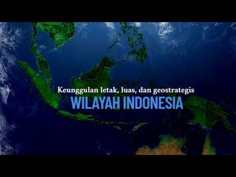
TLDRThis video explains the geographical conditions of Indonesia, detailing its position between two continents (Asia and Australia) and two oceans (Pacific and Indian). It explores the country's borders, both geographically and astronomically, and describes Indonesia's diverse natural features, such as its vast number of islands, coastal areas, mountains, and lowlands. The video also highlights the significance of these geographical traits, including Indonesia's classification as a maritime and archipelagic nation. Additionally, it discusses the impact of these conditions on the livelihoods of its people, particularly in agriculture, solidifying Indonesia's status as an agrarian country.
Takeaways
- 😀 Indonesia is located between two continents, Asia and Australia, and two oceans, the Pacific and Indian Oceans.
- 😀 The country spans a geographical range from 6°N to 11°S latitude and from 95°E to 141°E longitude, with the Equator passing through it.
- 😀 Indonesia consists of over 17,000 islands, making it an archipelagic nation with both large and small islands.
- 😀 The major islands of Indonesia include Sumatra, Kalimantan, Papua, Java, and Sulawesi.
- 😀 Java is the 13th largest island globally and is known for its densely populated regions and significant cities.
- 😀 Indonesia's climate is tropical, with distinct wet and dry seasons, and is influenced by its position near the Equator.
- 😀 Indonesia's geography includes a variety of natural landscapes, including beaches, plains, mountains, and rainforests.
- 😀 The country's geographical features make it a maritime and archipelagic nation, with many islands close together.
- 😀 Indonesia has a large number of lowland areas that are essential for agriculture, particularly rice cultivation.
- 😀 The country's economy is significantly shaped by agriculture, and it is considered an agrarian country due to the majority of people working in farming.
- 😀 Papua, Indonesia’s second-largest island, is home to a diverse ecosystem and has mountainous regions and coastal areas.
Q & A
What does 'geographical location' mean in the context of Indonesia?
-Geographical location refers to the position of a region on Earth, specifically in relation to other regions, and it includes both the natural environment and physical features.
What is the geographical location of Indonesia?
-Indonesia is located between two continents, Asia and Australia, and two oceans, the Pacific Ocean and the Indian Ocean.
How is the geographical location of Indonesia represented on a map?
-On a map, Indonesia is shown with different colors and is bordered by dashed lines, with directions indicated for north, south, east, and west.
What are the boundaries of Indonesia?
-The northern boundary of Indonesia includes the Andaman Sea, Malaysia, Singapore, the South China Sea, the Philippines, and the Pacific Ocean. The southern boundary is marked by Australia and the Indian Ocean.
What is meant by 'astronomical location' of a country?
-Astronomical location refers to the position of a country determined by imaginary lines such as latitude and longitude.
What are the coordinates of Indonesia's astronomical location?
-Indonesia lies between 6°N and 11°S latitude, and 95°E to 141°E longitude.
What does it mean that Indonesia is a 'maritime' and 'archipelagic' country?
-Indonesia is called a maritime country because it has extensive seas and oceans surrounding it, and it is an archipelagic country because it consists of numerous islands that are close to each other.
How many islands does Indonesia have, and what are some of its large islands?
-Indonesia has about 17,400 islands, including large ones such as Sumatra, Kalimantan, Papua, Java, and Sulawesi.
What are some examples of the natural features of Java Island?
-Java Island has various natural features including beaches (e.g., Banyu Tibo, Anyer, Tanjung Lesung), lowlands (e.g., Batang, Semarang, Madiun), and mountains (e.g., Merapi, Slamet, Merbabu, Arjuno).
What makes Papua Island significant geographically in Indonesia?
-Papua is the second largest island in the world, and it is located in the eastern part of Indonesia. It shares its territory with Papua New Guinea, and Indonesia controls the western part of the island.
How does the condition of lowlands impact people's livelihoods in Indonesia?
-Lowlands in Indonesia are used for agriculture, industry, and settlement. As a result, many people in Indonesia work in agriculture, making the country agrarian in nature.
Outlines

This section is available to paid users only. Please upgrade to access this part.
Upgrade NowMindmap

This section is available to paid users only. Please upgrade to access this part.
Upgrade NowKeywords

This section is available to paid users only. Please upgrade to access this part.
Upgrade NowHighlights

This section is available to paid users only. Please upgrade to access this part.
Upgrade NowTranscripts

This section is available to paid users only. Please upgrade to access this part.
Upgrade NowBrowse More Related Video

ruangbelajar - Geografi VII SMP - Kondisi Geografis Indonesia | bimbel online

TERBENTUKNYA KEPULAUAN INDONESIA (SEJARAH INDONESIA)

MENGENAL LUAS DAN BATAS-BATAS WILAYAH INDONESIA 🇮🇩🇮🇩🇮🇩

KONDISI GEOGRAFIS INDONESIA - IPAS

BENUA DAN SAMUDERA |PROSES TERBENTUKNYA BENUA & SAMUDERA|
Keunggulan letak, luas dan geostrategi wilayah Indonesia
5.0 / 5 (0 votes)