Karakteristik Geografis Wilayah Indonesia | IPS SD
Summary
TLDRIndonesia is renowned for its stunning marine and terrestrial landscapes. The country's geography is diverse, with vast seas, islands, mountains, and fertile plains. It is an archipelago with over 17,000 islands, located between two continents and two oceans. Indonesia's geographical position influences its tropical climate, with distinct wet and dry seasons. The country's rich natural resources, from fertile lands to abundant seas, support various cultures and industries. Indonesia's diverse cultures and ecosystems, shaped by its geography, contribute to the nation's unique identity and economic potential. Protecting this natural wealth is essential for future prosperity.
Takeaways
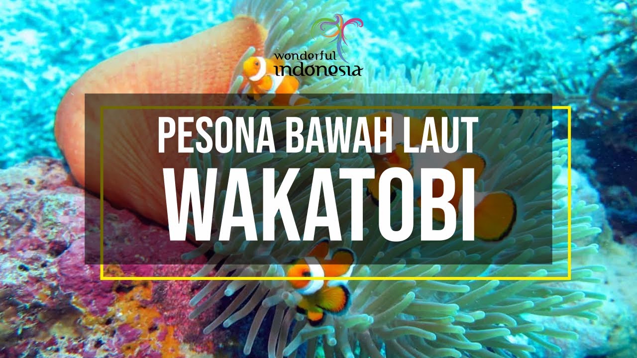
- 😀 Indonesia is famous for its beautiful underwater landscapes, including a variety of fish, shells, sea plants, and coral reefs.
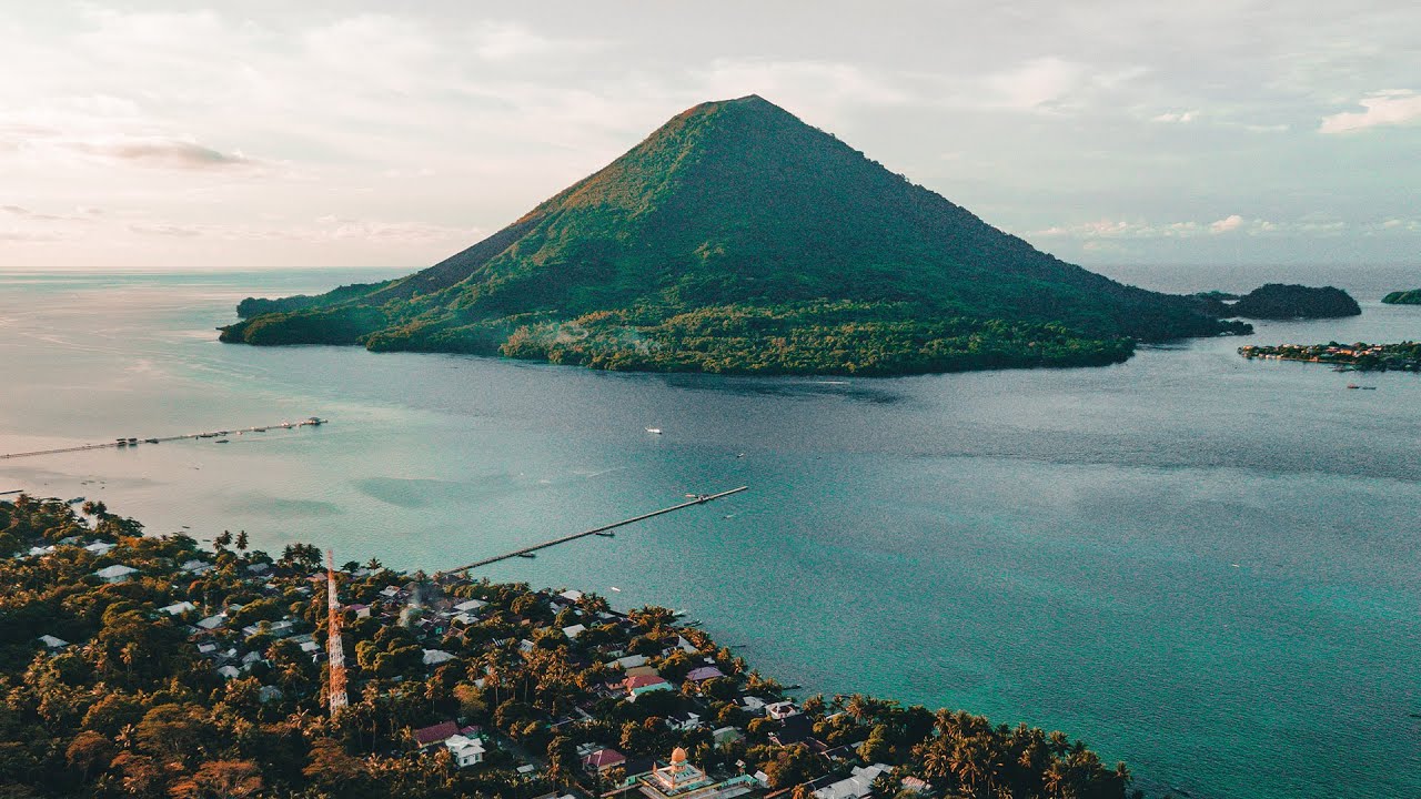
- 😀 The country has not only beautiful waters but also stunning land areas with mountains, valleys, plains, and grasslands.
- 😀 Indonesia is a maritime country with vast oceanic territories, even larger than its landmass, which holds potential for food, energy, and scientific knowledge.
- 😀 Indonesia is also an agrarian nation with fertile land, making it ideal for agriculture and plantation industries.
- 😀 Indonesia is an archipelagic country consisting of around 17,000 islands, including five major islands: Sumatra, Java, Kalimantan, Sulawesi, and Papua.
- 😀 The country is situated between two continents (Asia and Australia) and two oceans (the Pacific and Indian Oceans), which influences its climate and geography.
- 😀 Indonesia's geographical location results in three types of climate: monsoon, tropical, and maritime climates.
- 😀 The monsoon winds from Australia bring dry weather (hot season), while the monsoon winds from Asia bring wet weather (rainy season), contributing to the tropical climate.
- 😀 Indonesia serves as a key global trade route due to its strategic location, facilitating cultural and economic exchanges.
- 😀 Indonesia's diverse geography leads to varied cultural traditions, such as floating houses and markets in Kalimantan and agricultural ceremonies in Java.
- 😀 Population density is highest on the islands of Java and Bali due to fertile land and economic opportunities, attracting migration and tourism.
Q & A
What makes Indonesia's underwater scenery unique?
-Indonesia is famous for its beautiful underwater scenery, featuring diverse fish species, shells, marine plants, and coral reefs that contribute to its appeal.
What are the main types of geographic features in Indonesia?
-Indonesia has both water and land regions. The water features include seas, lakes, reservoirs, rivers, and bays, while the land features include highlands, lowlands, mountains, hills, valleys, and grasslands.
Why is Indonesia called a maritime nation?
-Indonesia is considered a maritime nation because its sea area is significantly larger than its land area, making the seas a key part of the nation's identity.
What makes Indonesia an agrarian country?
-Indonesia is called an agrarian country due to its fertile land, which is ideal for agriculture and plantations, contributing to its economy.
What are the three climates found in Indonesia?
-Indonesia experiences three main climates: monsoon, tropical, and maritime. The monsoon climate is influenced by the wind pattern, with a dry season caused by the east monsoon and a wet season caused by the west monsoon. The tropical climate brings warm temperatures year-round, and the maritime climate results in high rainfall and humidity.
How does Indonesia's geographical location impact its climate?
-Indonesia's position between two continents, Australia and Asia, and two oceans, the Pacific and the Indian Ocean, leads to its diverse climate zones, such as the dry season from the east monsoon and the wet season from the west monsoon.
What is Indonesia's role in global trade due to its geographical location?
-Indonesia serves as a strategic global trade route because of its location at the crossroads between Asia and Australia, surrounded by the Pacific and Indian Oceans.
How has Indonesia's geographical separation influenced its cultural diversity?
-Indonesia's islands are separated by water, which has led to diverse cultures, languages, traditions, and natural resources, contributing to the country's rich cultural and natural heritage.
How does the geography of Indonesia affect its population distribution?
-Indonesia's geography results in a high population density on islands like Java and Bali, where the land is fertile, and there are significant economic and governmental centers. This draws many people to migrate there.
What environmental practices can help protect Indonesia's natural resources?
-To protect Indonesia's natural resources, it is important to maintain cleanliness, use water, fuel, and electricity wisely, and be mindful of environmental sustainability.
Outlines

This section is available to paid users only. Please upgrade to access this part.
Upgrade NowMindmap

This section is available to paid users only. Please upgrade to access this part.
Upgrade NowKeywords

This section is available to paid users only. Please upgrade to access this part.
Upgrade NowHighlights

This section is available to paid users only. Please upgrade to access this part.
Upgrade NowTranscripts

This section is available to paid users only. Please upgrade to access this part.
Upgrade NowBrowse More Related Video


5.0 / 5 (0 votes)