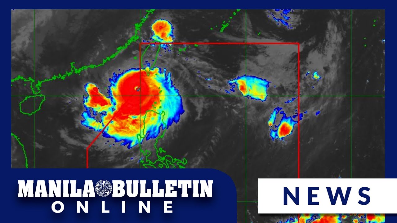
BAGYONG JULIAN POSIBLENG UMABOT SA SUPER TYPHOON CATEGORY ALAMIN! WEATHER UPDATE | SEPT. 29, 2024
Summary
TLDRThe Philippine Atmospheric, Geophysical, and Astronomical Services Administration (PAGASA) reports Tropical Depression Julian is intensifying and moving towards Northern Luzon, potentially reaching Typhoon or Super Typhoon status. Residents are warned of possible flooding and landslides. PAGASA also monitors Typhoon Jebi outside the Philippine area of responsibility. Expected heavy rains and strong winds are forecasted for several regions, with tropical cyclone wind signals raised in Batanes, Cagayan, and Babuyan Islands, among others.
Takeaways
- 🌪️ Tropical Depression Julian (Kraton) is approaching Northern Luzon, currently in the Philippine Sea east of Apari, Cagayan.
- 💨 Julian has winds of 75 km/h with gusts up to 80 km/h, expected to intensify and possibly reach typhoon or super typhoon strength by Sunday or Monday.
- ⚠️ Residents are advised to be cautious of flooding and landslides due to heavy rains.
- 🌊 There is a second tropical storm, Typhoon Jebi, currently outside the Philippine area of responsibility (PAR), with no direct impact expected on the country.
- ⏳ By September 30, Julian is forecasted to be 215 km east-northeast of Apari, Cagayan, and may reach typhoon strength, with a possible landfall by Monday or Tuesday.
- 📍 Typhoon signal warnings are in effect for areas including Batanes, Cagayan, Babuyan Islands, Isabela, and parts of the Cordillera region.
- 🌧️ Heavy to intense rainfall is expected across northern Luzon, especially in the Babuyan Islands and parts of Cagayan and Ilocos Norte.
- ⛅ Strong to gale-force winds are expected in several regions including Aurora, Calabarzon, Romblon, and the Bicol Region by Monday.
- 🌊 Rough sea conditions up to 6 meters are expected in the seaboards of Batanes and Babuyan Islands, with moderate to heavy seas around other parts of northern Luzon.
- 📢 DOST PAGASA continues to monitor the situation, urging vigilance as Tropical Depression Julian intensifies and approaches land.
Q & A
What is the current status of Tropical Depression Julian?
-Tropical Depression Julian is approaching Northern Luzon while still in the Philippine Sea, east of Aparri, Cagayan.
How strong are the winds associated with Tropical Depression Julian?
-Tropical Depression Julian has maximum sustained winds of 75 km/h near its center, with gusts reaching up to 80 km/h.
Is Tropical Depression Julian expected to intensify?
-Yes, Tropical Depression Julian is expected to intensify into a typhoon and could even reach super typhoon category by Sunday or Monday.
Which areas are advised to take precautions due to possible heavy rainfall and landslides?
-Residents in areas prone to flooding or landslides, especially in Northern Luzon, are advised to take precautions.
What is the forecasted track of Tropical Depression Julian?
-Tropical Depression Julian is expected to be 215 km east-northeast of Aparri, Cagayan by September 30, 2024, and will intensify to a severe tropical storm before approaching Batanes and Babuyan Islands by Monday or early Tuesday.
What is the significance of Tropical Cyclone Wind Signal No. 2 in relation to Tropical Depression Julian?
-Tropical Cyclone Wind Signal No. 2 has been raised in Batanes, Cagayan (including Babuyan Islands), Isabela, Abra, Apayao, Kalinga, and parts of Mountain Province, signaling that these areas may experience strong winds and heavy rainfall.
Are there any other tropical storms being monitored aside from Julian?
-Yes, PAGASA is also monitoring Tropical Storm Jebi, which is currently outside the Philippine Area of Responsibility and has no direct impact on the country.
What weather conditions are expected on Monday due to Tropical Depression Julian?
-Heavy to intense rainfall is expected in Babuyan Islands, while moderate to heavy rains are expected in Batanes, mainland Cagayan, Isabela, and Ilocos Norte.
What kind of sea conditions should be expected in affected areas?
-Rough sea conditions with waves up to 6 meters are expected along the seaboards of Batanes and Babuyan Islands, while waves up to 4 meters are expected in northern Cagayan and Ilocos Norte.
When is Tropical Depression Julian expected to make landfall or approach land?
-Tropical Depression Julian is forecast to either make landfall or closely approach Batanes and Babuyan Islands by Monday night or early Tuesday.
Outlines

This section is available to paid users only. Please upgrade to access this part.
Upgrade NowMindmap

This section is available to paid users only. Please upgrade to access this part.
Upgrade NowKeywords

This section is available to paid users only. Please upgrade to access this part.
Upgrade NowHighlights

This section is available to paid users only. Please upgrade to access this part.
Upgrade NowTranscripts

This section is available to paid users only. Please upgrade to access this part.
Upgrade NowBrowse More Related Video

Storm trough, ‘habagat’ to bring rains across parts of the Philippines

Signal No. 2 up in parts of Batanes as Typhoon Carina slightly intensifies | INQToday

24 Oras: PAGASA: Bagyong Ompong, magtatagal sa loob ng PAR hanggang Biyernes

‘Julian’ intensifies into super typhoon as it slowly moves away from the Philippines

Public Weather Forecast issued at 4PM | September 13, 2024 - Friday

Bagyong "Bebinca" na nasa labas ng PAR, lumakas at bumilis | 24 Oras
5.0 / 5 (0 votes)