O que é CARTOGRAFIA? | Resumo
Summary
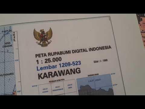
TLDRCartography is the science of creating maps, playing a vital role in understanding geographical, social, economic, historical, and cultural phenomena. Originating in prehistory, it evolved with the development of tools like the compass and astrolabe, aiding in precise navigation. Today, modern cartography uses satellites and Geographic Information Systems (GIS) to produce detailed, interactive maps. With coordinates like latitude and longitude, it enables us to locate specific points on Earth. This field continues to shape our understanding of the world, from forest management to disaster response and exploration.
Takeaways
- 😀 Cartography is the science of graphically representing geographic areas.
- 😀 It plays a significant role in understanding social, economic, historical, and cultural realities.
- 😀 Cartography helps to comprehend various phenomena like land use, forest management, and road construction.
- 😀 It has applications in the study of mineral resources, emergency response, and navigation.
- 😀 Cartography dates back to prehistory, where it was used for hunting and fishing territory representation.
- 😀 Ptolemy's work in ancient Greece contributed to the understanding of the Earth's spherical shape and influenced medieval map-making.
- 😀 The Age of Exploration brought the need for new cartographic techniques, leading to more accurate maps.
- 😀 Instruments like the compass and astrolabe were essential in improving navigation accuracy and map detail.
- 😀 Coordinates, using latitude and longitude, are crucial for locating specific points on Earth's surface.
- 😀 Modern cartography, enhanced by satellites and GIS software, provides detailed and interactive maps for various uses.
Q & A
What is cartography and what is its primary function?
-Cartography is the science of representing geographical areas graphically. Its primary function is to create maps, which help in understanding physical, social, economic, historical, and cultural realities.
How is cartography used beyond physical representation?
-Beyond physical representation, cartography is used to illustrate social, economic, historical, and cultural aspects, while also supporting scientific investigations in various fields like geography, history, and mathematics.
Why is cartography important in modern civilization?
-In modern civilization, cartography plays a crucial role in understanding geographical and social phenomena, such as land use, forestry management, road construction, natural resource distribution, and emergency responses.
When did cartography first begin to be used, and for what purposes?
-Cartography dates back to prehistoric times, when maps were used to represent territories for hunting and fishing. Ancient Babylonian maps depicted the world as a flat disc.
Who was the key figure in developing early cartographic models, and what did they contribute?
-Ptolemy, an ancient Greek scholar, contributed significantly to cartography by creating a series of maps in eight volumes that demonstrated the spherical shape of the Earth.
What role did the Age of Discovery play in the advancement of cartography?
-During the Age of Discovery, the need for new cartographic techniques arose, particularly with the discovery of the New World. This period saw advancements in mapmaking and the systematic representation of the Earth's surface.
What technological inventions significantly advanced cartography during the Age of Discovery?
-The compass and the astrolabe were key inventions that advanced cartography by enabling more accurate navigation and the creation of more detailed maps.
What are geographical coordinates, and how are they used in cartography?
-Geographical coordinates are used to locate a specific point on the Earth's surface. They consist of latitude, which measures north or south of the Equator, and longitude, which measures east or west of the Prime Meridian in Greenwich.
How are latitude and longitude measured and represented?
-Latitude is measured in degrees from the Equator, ranging from 0° to 90° North or South. Longitude is measured in degrees from the Prime Meridian, ranging from 0° to 180° East or West.
How has modern satellite technology impacted cartography?
-Modern satellite technology has revolutionized cartography by providing more detailed and accurate maps, as well as the ability to monitor geographical phenomena in real-time.
What are GIS (Geographic Information Systems), and how do they contribute to cartography?
-Geographic Information Systems (GIS) are software systems that allow for the creation, analysis, and manipulation of maps. They enable the integration of various data layers, making it possible to create interactive maps with diverse applications in fields like urban planning, environmental management, and disaster response.
Outlines

このセクションは有料ユーザー限定です。 アクセスするには、アップグレードをお願いします。
今すぐアップグレードMindmap

このセクションは有料ユーザー限定です。 アクセスするには、アップグレードをお願いします。
今すぐアップグレードKeywords

このセクションは有料ユーザー限定です。 アクセスするには、アップグレードをお願いします。
今すぐアップグレードHighlights

このセクションは有料ユーザー限定です。 アクセスするには、アップグレードをお願いします。
今すぐアップグレードTranscripts

このセクションは有料ユーザー限定です。 アクセスするには、アップグレードをお願いします。
今すぐアップグレード


5.0 / 5 (0 votes)
