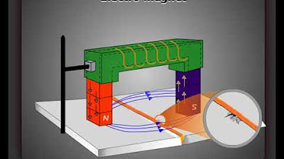
Metode Magnetik | Geophysics Exhibition GeoFest ITERA 2021
Summary
TLDRIn this video, two geophysical engineering students from Institut Teknologi Sumatera introduce the magnetic method, a geophysical technique used to measure variations in the Earth's magnetic field to study subsurface structures. They explain the tools involved, particularly the Proton Magnetometer and GPS, as well as the process for field measurements, including setting up the equipment, adjusting time and survey intervals, and interpreting the magnetic data. The video serves as a comprehensive guide to understanding how the magnetic method works in practical geophysical applications.
Takeaways
- 😀 Introduction: The speakers are Geophysical Engineering students at the Institute of Technology Sumatera, discussing the magnetic method in geophysics.
- 😀 The magnetic method is an active geophysical technique that measures variations in Earth's magnetic field to study subsurface structures and rock magnetism.
- 😀 Magnetic surveys rely on proton magnetometers, GPS devices, and support poles for accurate field measurements of magnetic intensity.
- 😀 The proton magnetometer's sensor contains a proton fluid that aligns during measurements to detect variations in the magnetic field.
- 😀 The GPS is used to track the exact location of measurement points during surveys, ensuring accurate data collection.
- 😀 The proton magnetometer has both a base and mobile version, where the base version measures stationary magnetic intensity, and the mobile version is used for fieldwork across multiple locations.
- 😀 The magnetometer is activated by pressing the start button, with different menus for setting up the equipment before conducting field measurements.
- 😀 The survey menu on the proton magnetometer allows the user to configure time, including the day, year, month, date, hour, minute, and second for accurate timestamping of measurements.
- 😀 The measurement intervals for the proton magnetometer differ depending on whether the survey is conducted from a stationary base or while mobile. Mobile measurements use shorter intervals, typically in seconds.
- 😀 The setup of the proton magnetometer includes adjusting settings for time and measurement frequency, followed by initiating the survey mode to begin data collection in the field.
- 😀 After configuring the device, the survey starts, and the proton magnetometer begins measuring the magnetic field intensity, which is recorded for analysis.
Q & A
What is the primary objective of the video presented by the speakers?
-The primary objective is to explain the magnetic method in geophysics, including the tools used and the step-by-step process of conducting a magnetic survey in the field.
What are the key tools used in the magnetic survey method as introduced in the video?
-The key tools introduced are the Proton magnetometer, GPS, and a supporting pole for the magnetometer sensor.
How does the Proton magnetometer work in the context of magnetic surveying?
-The Proton magnetometer measures variations in the Earth's magnetic field by detecting changes in magnetic intensity, which are used to infer subsurface structures and rock magnetism.
What is the role of the GPS in the magnetic survey process?
-The GPS is used to determine the precise location or position of each measurement point during the survey, ensuring accurate spatial data collection.
What does the 'Proton' in Proton magnetometer refer to?
-The 'Proton' refers to the sensor's use of proton-rich fluids that align in response to magnetic fields. When the device is turned on, these protons align at a specific point, allowing the magnetometer to measure the magnetic intensity.
What is the significance of the magnetic anomalies measured by the Proton magnetometer?
-Magnetic anomalies indicate variations in the Earth's magnetic field caused by different subsurface materials or structures. These anomalies are essential for understanding the geological features beneath the surface.
How is the time set for measurements in the Proton magnetometer during the survey?
-The time is set by inputting the day of the week, year, month, date, hour, minute, and second into the Proton magnetometer. This ensures the time of measurement is accurately recorded for later analysis.
What is the difference between setting the Proton magnetometer for 'Base' and 'Mobile' measurements?
-For 'Base' measurements, the time interval between readings is usually set in minutes, as it involves stationary measurements. For 'Mobile' measurements, the interval is set in seconds to account for moving from one measurement point to another.
What are the main modes available in the Proton magnetometer during the survey?
-The main modes are 'Survey Mode', used for conducting the survey, and 'Safe Mode', which is used to prepare and finalize the measurement setup.
Why is it important to configure the Proton magnetometer correctly before starting the survey?
-Proper configuration ensures that the measurements are accurate, synchronized with the correct time, and taken at appropriate intervals. This is essential for obtaining reliable data about the magnetic anomalies in the survey area.
Outlines

このセクションは有料ユーザー限定です。 アクセスするには、アップグレードをお願いします。
今すぐアップグレードMindmap

このセクションは有料ユーザー限定です。 アクセスするには、アップグレードをお願いします。
今すぐアップグレードKeywords

このセクションは有料ユーザー限定です。 アクセスするには、アップグレードをお願いします。
今すぐアップグレードHighlights

このセクションは有料ユーザー限定です。 アクセスするには、アップグレードをお願いします。
今すぐアップグレードTranscripts

このセクションは有料ユーザー限定です。 アクセスするには、アップグレードをお願いします。
今すぐアップグレード5.0 / 5 (0 votes)


