Interior of the Earth - Chapter 3 Geography NCERT Class 11
Summary
TLDRThis educational video script delves into the Earth's interior, exploring its layers—core, mantle, and crust—and the dynamic processes within. It distinguishes between endogenous forces like volcanic activity and exogenous ones such as erosion, shaping our landscapes. The script underscores the significance of understanding these processes for human settlement and disaster mitigation. It also discusses how scientists gather information about the Earth's interior through direct observations, like deep drilling, and indirect methods, including gravitational anomalies. The video concludes with an overview of earthquake types, their measurement, and effects, promising further exploration in linked videos.
Takeaways
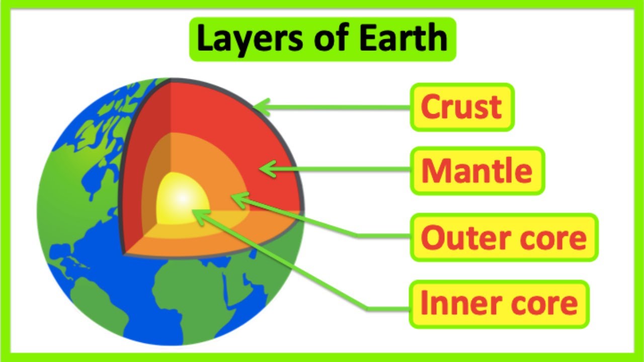
- 🌏 The interior of the Earth consists of the core, mantle, and crust, which are in a constant state of change.
- 🌋 Endogenous processes such as volcanic activity and tectonic plate movements shape the Earth's landscape, while exogenous processes like weathering and erosion modify its surface.
- 🏙️ Population density is higher in flat areas due to the influence of physiographic conditions on human settlement.
- 🌪️ Understanding the Earth's interior helps in predicting and mitigating the impact of natural disasters like earthquakes and tsunamis.
- 🔍 Direct observation of rocks and analysis of materials from deep drilling and volcanic eruptions provide insights into the Earth's interior.
- 📊 Indirect sources of information about the Earth's interior include temperature, pressure, and density changes with depth, as well as meteorite studies.
- 📉 Gravity anomalies indicate variations in the Earth's mass distribution, with higher gravity at the poles suggesting greater mass concentration.
- 💥 There are different types of earthquakes, including tectonic, volcanic, collapse, explosion, and reservoir-induced, each with unique causes and effects.
- 📈 Earthquakes are measured using the Richter scale for magnitude and the Mercalli scale for intensity.
- 🌋 Volcanoes release magma from the asthenosphere, leading to various volcanic landforms and the release of gases and pyroclastic materials.
Q & A
What are the three main layers of the Earth's interior?
-The three main layers of the Earth's interior are the core, mantle, and crust.
What are endogenous processes and how do they affect the landscape?
-Endogenous processes are internal geological activities such as volcanic activities, folding of the crust, and faulting due to plate tectonic activities. These processes change the landscape by shaping the Earth's surface features.
How do exogenous processes contribute to changes in the landscape?
-Exogenous processes are external activities like weathering, erosion, transportation, deposition, and denudation. These processes alter the outer physical shape of a landscape by wearing down and reshaping the Earth's surface.
Why is it important to understand the interior of the Earth in relation to human settlements?
-Understanding the interior of the Earth is important because human settlements are largely based on the physiographic conditions of a region. Knowledge of these conditions can help predict and mitigate risks from natural calamities such as floods and landslides.
What are the two ways scientists collect information about the Earth's interior?
-Scientists collect information about the Earth's interior through direct observations and analysis of materials. This includes studying rocks from the surface and mining areas, as well as materials that come out from the interior, such as magma during volcanic eruptions.
What is the significance of the Cola deep drill in Arctic Ocean?
-The Cola deep drill in the Arctic Ocean is significant because it is the deepest drill to date, reaching a depth of 12 km. This is an important effort to gather information about the Earth's interior, although it is still only half the depth of the continental crust.
How do indirect sources of information contribute to our understanding of the Earth's interior?
-Indirect sources of information, such as changes in temperature, pressure, and density with depth, meteorites, and variations in the Earth's gravitational field, contribute to our understanding of the Earth's interior by providing data that scientists can analyze to estimate the conditions within the Earth.
What are the different types of earthquakes mentioned in the script?
-The script mentions five types of earthquakes: tectonic, volcanic, collapse, explosion, and reservoir-induced earthquakes.
How are the strength and intensity of an earthquake measured?
-The strength or magnitude of an earthquake is measured using the Richter scale, while the intensity is determined by the Mercalli scale, which ranges from 1 to 12.
What is the role of the asthenosphere in volcanic activity?
-The asthenosphere, part of the upper mantle, contains molten rock called magma that moves and causes instability in the crust. This movement can lead to seismic activities and is the source of magma that erupts from volcanoes as lava.
Outlines
🌍 Understanding Earth's Interior
This paragraph delves into the concept of Earth's interior, encompassing its core, mantle, and crust. It emphasizes the significance of comprehending the constant changes within Earth's layers for grasping landscape dynamics. The distinction between endogenous (internal processes like volcanic activities and plate tectonics) and exogenous (external processes like weathering and erosion) processes is highlighted. The paragraph also underscores the relevance of this knowledge for human settlements, especially in the context of natural disasters. It introduces the methods of studying Earth's interior, such as direct observations from rocks and materials from deep drilling projects and volcanic eruptions, and indirect observations like temperature, pressure, and density changes with depth.
🌐 Indirect Sources of Earth's Interior Information
The second paragraph focuses on indirect sources that provide insights into Earth's interior. It discusses how temperature and pressure increase with depth, and how density changes are observed through mining activities. The paragraph also mentions the use of meteorites as a source of information, given their composition is similar to Earth's materials. Gravitational anomalies, magnetic fields, and seismic activities are highlighted as crucial indirect sources. The concept of gravity anomalies is explained, linking it to the Earth's shape and material distribution. The paragraph transitions into a discussion on the types of earthquakes, their causes, and the tools used to measure them, such as seismographs, and the Richter and Mercalli scales.
🌋 Earthquakes and Volcanic Landforms
The final paragraph addresses the effects of earthquakes on landforms and human life, detailing the various consequences of seismic activities. It distinguishes between high-magnitude earthquakes that are rare but highly destructive and the more frequent, low-magnitude tremors. The structure of the Earth is briefly mentioned, with a reference to a separate video for detailed information. The paragraph then shifts to volcanoes, explaining the origin of magma and the materials emitted during volcanic eruptions. Different types of volcanoes and their landforms are introduced, with a prompt to view another video for a comprehensive understanding. The paragraph concludes by summarizing the chapter's coverage of Earth's interior and encourages viewers to explore the provided resources for further learning.
Mindmap
Keywords
💡Interior of the Earth
💡Endogenous processes
💡Exogenous processes
💡Physiographic conditions
💡Natural calamities
💡Direct observation
💡Volcanic activities
💡Gravity anomaly
💡Tectonic earthquakes
💡Seismograph
💡Volcanic landforms
Highlights
The chapter explores the Earth's interior, including the core, mantle, and crust.
Understanding the Earth's interior is crucial for comprehending constant changes within the planet.
Landscapes are shaped by both endogenous (internal) and exogenous (external) processes.
Endogenous processes include volcanic activities, crust folding, and plate tectonics.
Exogenous processes involve weathering, erosion, transportation, and deposition.
Knowledge of the Earth's interior is vital for human settlements and understanding natural calamities.
The Earth's radius is 6370 km, and direct observations are limited due to inaccessibility.
Direct sources of information include rocks from the Earth's interior, such as those from mining.
Deep drilling projects, like the one in the Arctic Ocean, provide insights into the Earth's layers.
Volcanic eruptions offer another direct source of information through magma analysis.
Indirect sources of information include temperature, pressure, and density changes with depth.
Meteorites provide information about the Earth's interior as they are composed of similar material.
Gravitational anomalies indicate variations in Earth's mass distribution.
Tectonic earthquakes result from the breaking and sliding of the Earth's crust.
Volcanic earthquakes are associated with magma movement and pressure changes around volcanoes.
Collapse earthquakes occur in areas of intense mining activity due to underground mine roof collapses.
Explosion earthquakes are manmade, caused by the detonation of chemical or nuclear devices.
Reservoir-induced earthquakes happen in areas with large water reservoirs due to water pressure on the crust.
Seismographs measure earthquake vibrations, and the Richter scale quantifies their magnitude.
Earthquakes have various effects on landforms and human life, with high-magnitude events causing significant damage.
The chapter provides a comprehensive understanding of the Earth's interior and its impact on our world.
Transcripts
this chapter is about the interior of
the earth when we say interior we are
talking about the inside of Earth so if
you are familiar with this diagram the
different layers of earth that is the
core mantle and crust these all together
make the interior of the earth and there
is a constant change that is going on
inside the earth knowing those changes
requires us to understand the interior
of the earth that is what we are going
to learn in this chapter the landscape
that we see around us is a result of a
constant endogenous and exogenous
process
so endogenous means internal and
exogenous is external now internal
processes such as volcanic activities
folding of the crust and faulting due to
plate tectonic activities so all these
process change the landscape and they
are collectively known as endogenous
processes now exogenous process are
those activities like weathering erosion
Transportation deposition denudation all
these acts causes changes to the outer
physical shape of a
landscape the main reason it is
important to know about the interior of
the earth is due to the fact that human
settlement is largely based on
physiographic conditions of a region
that's why you'll see in plain areas the
population is more compared to hilly and
mountainous region now we have seen a
lot of times due to natural calamities
like flood Landslide there's a huge risk
towards human life as well as properties
and if we know why the Earth shakes or
how a tsunami wave is generated that
will help us in creating necessary
mechanisms that will protect us from any
any of such natural calamities again
going back to this diagram about
different layers of earth scientists
have gathered enough information and
various characteristics about each of
these layers so this chapter will
basically help us know more about these
layers let's read some information about
the interior of our Earth the Earth's
radius is 6370 km and no one can reach
the center of the earth and it is
obvious as to why we cannot so in that
case we only have two ways of collecting
information about the interior of our
Earth and that is through direct
observations and Analysis of
materials first let's know about some
direct sources under direct sources we
have rocks that are like a strong
evidence which we can use to know the
interior of the Earth the rocks that we
see on the surface or the Rocks we get
from mining areas they all speak
something about the interior of the
Earth but it is generally said that if
we can get some rocks that are direct
from the interior we have better
information that will lead us some where
because the surface rocks undergo
constant weathering due to rain and wind
hence it is not as good as an interior
Rock from a mine that's why we have many
scientific projects around the world
that penetrate into deeper depth to
explore the conditions there are
projects like deep ocean drilling
project and integrated ocean drilling
project to gather large volume of
information and analyze materials for
understanding the interior of Earth just
a quick information here the the deepest
drill is at Cola which is in Arctic
Ocean and it has so far reached a depth
of 12 km the crust that is the upper
layer of the Earth is itself 30 km deep
from the continent not from the ocean
bed it is that thick so 12 km is just
half of it yet it has been the deepest
drill till date this is something to
think about so this was the drill part
for gathering information another way is
to analyze the material that comes out
automatically from the interior I'm
referring to the volcanic activities
volcanic eruption forms another source
of obtaining direct information so
whenever there is any volcanic eruption
a sample of the magma is tested around
the globe by scientists to determine its
components however it is difficult to
assume the depth of the source of such
magma meaning from where this magma has
evolved is it right from the core or is
it somewhere in between the Earth's
layers so there are some limitation when
the quest of knowledge is dependent on
Direct sources however it is far better
than going in person inside the earth
which can otherwise be
fatal now let's read about some indirect
sources that gives us information about
the interior so the temperature and
pressure increases as we go from the
surface towards the interior in deeper
depths now this information was observed
through mining activities another very
important information we know is that
the density of the material also
increases with depth now that we have
all all these facts scientists have
developed an estimation as to what the
temperature pressure and density of each
layer will be with respect to the total
thickness of the Earth again these are
estimation that is approximate values so
here you see a lot of mathematical
concept comes into play that's why it is
referred to as indirect sources another
source of information are the meteors
have you ever heard of meteor Shar
that's the time when meteors reach the
Earth since they are not part of Earth
you must realize that they are solid
bodies developed out of material similar
to that of Earth hence this becomes yet
another source of information about the
interior of the earth then other
indirect sources include gravitation
magnetic field and seismic activity so
gravitation force is not the same at
different latitudes it is greater near
the poles and less at the equator and
the reason is because the Earth is not a
perfect sphere it is bulged at its
Center so its distance from the Center
at the equator is comparatively more
than the poles the gravity keeps on
changing as we move from one place to
another but it is maximum at the place
where it is nearer to the center as a
result the gravity is more at the poles
and least at the equator now this change
in gravity reading is called gravity
anomaly the gravity values also differ
according to the mass of material and we
know that materials are unevenly
distributed on Earth moments back I told
you that gravity is more at the poles
than at equator therefore we can say
that the materials found at the pole
have higher Mass compared to the
materials found at equator and that's
why you will see North and South Pole
are rich in natural
resources the next topic is about
earthquake and I've made a separate
video on it I'll link the video in the
description and you can have a look at
it so now we are going to move on to the
topic types of earthquake the first one
is a common one and is known as tectonic
earthquakes whenever you to hear the
word tectonic we are referring to the
breaking of the crust part of the
Earth's surface so the breaking of the
crust part is due to Sliding of rocks
that creates a fault and that's what the
entire tectonic earthquake is all about
the second one is recognized as wanic
tectonic earthquake these are confined
to areas of active volcanoes now you see
this word tectonic again associated with
volcano so you know that volcanoes are
like a ventilator of the Earth's surface
from where the magma comes out whenever
the magma comes out of the volcano the
movement results in pressure changes in
the rock around where the magma has
experienced stress and at some point the
rock may break or move and when that
happens it's tectonic where in the crust
part of the Earth surface breaks
creating a fault the third one is called
as collapse earthquakes these take place
in areas of intense mining activity here
the roofs of underground mine collapse
causing minor tremors
as we know that mining involves a lot of
explosion of rock and that produces
seismic waves these waves are called
tors the fourth one is called explosion
earthquakes now by the word explosion
it's evident that we are talking about
something manmade or manually created
due to the explosion of chemical or
nuclear devices seismic waves are
produced and these waves produces
Tremors these Tremors move and break the
rocks and that creates an earthquake
which which is a total manually created
and the fifth one is Reservoir induced
earthquakes the earthquakes that occur
in the areas of large reservoirs are
referred to as Reservoir induced
earthquakes to explain this I'll have to
show you an illustration you know what a
reservoir is right now when reservoirs
store water and I mean large quantity of
water that huge quantity of water
creates pressure now where does the
pressure hits it hits on the wall the
surface of the reservoir
now those walls in turn creates pressure
on nearby rocks if at all there is a
fault meaning a crack in the crust
because you never know where the falls
and cracks are inside the crust so if at
all there is one nearby to the reservoir
that will push large chunk of rocks and
that fault may increase in size there
you go we have a reservoir induced
earthquake the next topic that we are
going to talk about is measuring
earthquakes a seismograph is used to
detect the vibration caused by an
earthquake the strength or magnitude of
an earthquake is measured using the
Richer scale on an intensity scale of 0
to 10 10 being the highest the intensity
of the earthquake is determined by a
merali scale which ranges from 1 to 12
so richer scale determines the magnitude
of the earthquake and mercal scale
determines the intensity of the
earthquake remember that now let's read
about the effects of earthquake
so earthquake is a natural Hazard so
these are some effects of earthquake I
want you to quickly look at them there
are some 10 to 12 of them just have a
look at them now in this list the first
six have to do with land forms because
if you see ground shaking differential
ground settlement land and mudslides
soil liquefaction then ground lurching
Avalanches all these have links with
land forms and the remaining effects of
this list are concerned with the life
and properties of people in that region
so yeah just have a look at this list of
some hazardous effects of
earthquake earthquake with high
magnitude can cause heavy damage to the
life and property of people and not all
the parts of the globe necessarily
experience major shocks a magnitude of 8
plus is very rare and can occur once in
1 to 2 years whereas those of tiny types
occur almost every minute so basically
it is saying that there is a constant
change that is happening inside the
surface of the Earth
and those little changes are creating
tiny
Tremors the next topic is about the
structure of the earth I've again made a
separate video on it the video link is
in the description please have a look at
it we now move on to the next topic
volcanoes and Volcanic landforms we all
know what a volcano is we have seen
pictures of it releasing gases ashes
then molten rock material lava to the
ground so the question now is where does
the magma inside the volcano comes from
so let's understand it with a simple
illustration below the volcano is the
crust which is the upper layer of the
Earth after crust it's the mantle
actually the mantle is divided into two
parts if you remember upper mantle and
lower mantle and we have also read that
the upper mantle is also called as
asthenosphere where ASO means weak here
the rocks are in molten fluid called
magma and is moving here and there and
that's what makes the crust unstable
causing seismic activities so it is from
this layer which is the astrosphere from
where the molten rock comes out of the
volcano as lava the material that
reaches the ground includes lava flows
pyroclastic debris volcanic bombs Ash
and dust and Gases such as nitrogen
compounds sulfur compounds and minor
amounts of chlorine hydrogen and argon
now volcanoes are of different types and
they are based on the nature of the
eruption and form I have another
separate video on different types of
volcanoes and their land forms the video
link is in the description just have a
look at it the reason I make topics like
these in separate videos so that they
can be referred easily by anyone at any
time you don't have to watch a long
video like this one and then get to a
point to understand one individual topic
so I hope you don't mind when I tell you
to go to so and so link for so and so
topic so don't forget to watch that
video as of now we are done with this
chapter this chapter dealt with the
interior of the Earth in a nice
comprehensive manner I hope you found
this video informative the question
answer of this chapter can be found on
the website the link is there in the
description as well as usual thanks for
watching and I'll see you in the next
one if you enjoy these videos and see a
purpose behind watching them please like
the video and comment down below until
then catch you guys later and talk to
you guys on the next one peace
関連動画をさらに表示
Layers of the Earth
Seismic Waves: On Exploring Earth's Interior
How earthquakes show us the inside of the Earth
Earthquakes and Seismology in Earth’s Interior
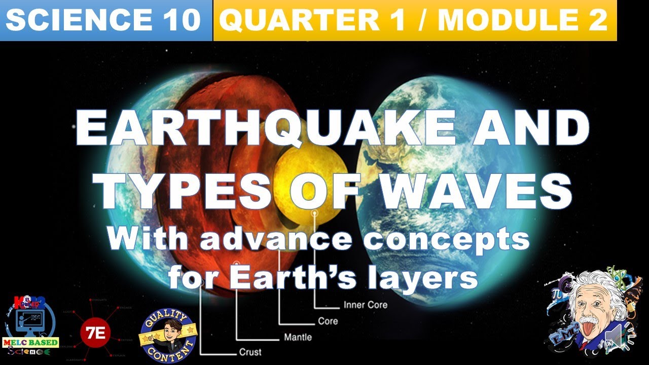
GRADE 10 SCIENCE QUARTER 1, MODULE 2 WEEK 2, EARTHQUAKE AND TYPES OF WAVES MELC BASED.
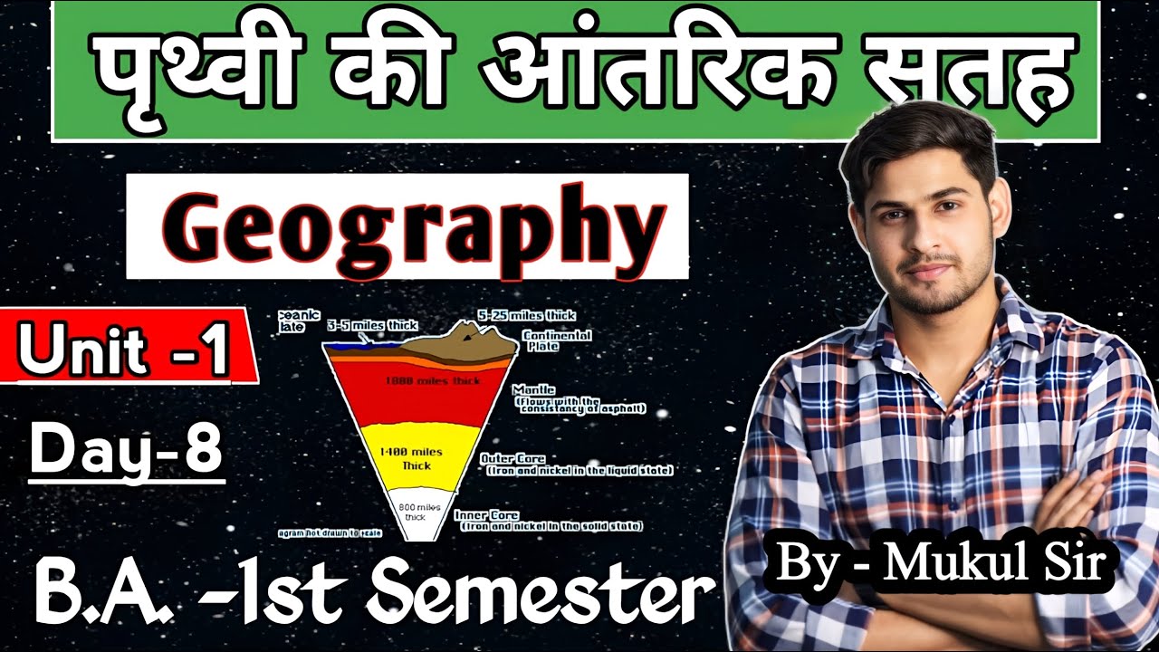
Day-8 || BA 1st semester geography Unit-1 ( Interior of Earth 🌍) by Mukul Sir #geography #earth
5.0 / 5 (0 votes)