Pengenalan Global Positioning System (GPS) / Sistem Pemosisi Global | #gps #perpetaan #sig

Sadidan Ikhwanussafa
19 Aug 202212:03

Summary

TLDRThis educational video delves into the Global Positioning System (GPS), explaining its function as a system for determining locations on Earth using satellite signals. It covers the history of GPS, starting as a military project by the U.S. Department of Defense and evolving into a global utility. The video discusses the three segments of GPS: control, satellite, and user segments, and the role of each. It also touches on various satellite types, the significance of satellite navigation, and the impact of signal obstructions. The script concludes with an overview of GPS applications, from military to civilian uses, and the benefits and drawbacks of different GPS satellite systems launched by various countries.

Takeaways

  • 🌐 The Global Positioning System (GPS) is a system used to determine locations on Earth's surface with the help of satellite signals.
  • 📡 GPS stands for Global Positioning System, but in the video, the term GPS is used as a shorthand for the system.
  • 🌌 A satellite is an object that orbits a planet, with natural satellites like the Moon and artificial satellites launched by various countries for different purposes.
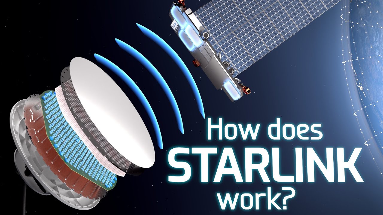
  • 🛰️ GPS specifically uses navigation satellites that transmit radio signals to receivers on Earth to determine location and direction.
  • 🔄 The GPS system consists of three segments: the control segment that oversees the satellites, the space segment which are the satellites themselves, and the user segment that receives signals from the satellites.
  • 🌍 Multiple countries have launched their own navigation satellites, each with unique characteristics and features, contributing to the global GPS network.
  • 🚀 GPS was initially developed for military use by the United States Department of Defense, but later made available for civilian use to enhance various applications.
  • 📱 There are various types of GPS devices, from those used in vehicles and marine to sports GPS devices like smartwatches, handheld GPS for aviation, and smartphones.
  • 🧭 GPS accuracy can vary, with an approximate accuracy of 4.9 meters under open sky conditions, but can be affected by obstacles like buildings or dense forests.
  • ⏲️ GPS signals can be disrupted by satellite orbital errors, geometry issues, insufficient tracked satellites, and selective availability which can be influenced by administrative restrictions.

Q & A

  • What is GPS and what does it stand for?

    -GPS stands for Global Positioning System. It is a system used to determine locations on the Earth's surface with the help of satellite signals.

  • What is the Indonesian term for GPS?

    -In Indonesian, GPS is referred to as 'Sistem Pemosisi Global'.

  • What are satellites and what are the different types mentioned in the script?

    -Satellites are objects that orbit around a planet. In the script, it mentions natural satellites like the moon and artificial satellites such as those for astronomy, Earth observation, communication, and weather.

  • What is the role of satellites in the Global Positioning System?

    -In GPS, satellites are used for navigation, sending radio signals to receivers on the Earth's surface to determine location or position.

  • What are the three segments of the GPS system mentioned in the script?

    -The three segments of the GPS system are the control segment, the satellite segment, and the user segment.

  • How many satellites are needed for a GPS receiver to determine a position?

    -A minimum of three satellites are needed for a GPS receiver to determine a position.

  • What is the historical background of GPS mentioned in the script?

    -GPS was initially developed by the U.S. Department of Defense for military use and was first launched in 1978. It was later made available for civilian use by President Ronald Reagan in 1983.

  • What are some of the benefits and applications of GPS mentioned in the script?

    -GPS has been used for military purposes, disaster prevention, monitoring Earth's conditions, and as a tool for geographic information systems, tracking, and disaster detection.

  • What are the different types of GPS devices mentioned in the script?

    -The script mentions GPS devices used in vehicles, marine GPS, sports GPS like smartwatches, handheld GPS, aircraft GPS, and geodetic GPS.

  • What factors can affect the accuracy of GPS signals?

    -Factors affecting GPS signal accuracy include buildings, dense forests, orbital errors, satellite geometry, insufficient tracked satellites, and selective availability.

  • What are the two tasks given at the end of the script?

    -The two tasks are to create a presentation about the benefits and uses of GPS in environmental technology and to write about the advantages and disadvantages of the navigation satellites launched by various countries.

Outlines

00:00

🌐 Introduction to GPS and Satellite Navigation

This paragraph introduces the Global Positioning System (GPS), explaining it as a system used to determine locations on Earth's surface with the help of satellite signals. It distinguishes between natural satellites like the moon and artificial satellites, which are devices launched by experts to orbit the Earth for various purposes. The paragraph also discusses the different types of artificial satellites, including those for astronomy, Earth observation, communication, and weather. It emphasizes the role of navigation satellites in GPS, which use radio signals to determine position and direction for vehicles, aircraft, ships, and airlines. The Global Positioning System is comprised of three segments: the control segment, the space segment, and the user segment, all of which coordinate with each other. The paragraph concludes by mentioning that there are multiple GPS systems launched by different countries, each with its own characteristics.

05:02

🚀 History and Applications of GPS

Paragraph two delves into the history of GPS, highlighting its initial development by the U.S. Department of Defense for military purposes and its launch in 1978. It notes a shift in 1983 when President Ronald Reagan proposed making GPS available for civilian use, recognizing its potential beyond military applications. The paragraph outlines the evolution of GPS from a military tool to a multi-purpose technology used in navigation, disaster prevention, and environmental monitoring. It also discusses the variety of GPS devices, from those used in vehicles and marine to sports and geodetic applications, each with different levels of accuracy. The paragraph addresses the accuracy of GPS, which can reach about 4.9 meters in open-sky conditions, and mentions factors that can impede GPS signals, such as buildings, dense forests, and satellite-related issues like orbital errors and selective availability.

10:02

📝 Assignments and Conclusion

The final paragraph of the script assigns two tasks to the viewers. The first is to create a presentation about the benefits and uses of GPS in environmental technology. The second is to write about the advantages and disadvantages of the navigation satellites launched by various countries, as mentioned in the previous slides. The paragraph concludes with an apology for any shortcomings in the video and expresses hope that the information shared is beneficial. It ends with a farewell, indicating the end of the video.

Mindmap

Keywords

💡Global Positioning System (GPS)

GPS is a satellite-based navigation system that provides geolocation and time information to a GPS receiver anywhere on or near the Earth where there is an unobstructed line of sight to four or more GPS satellites. In the video, GPS is the central theme, discussed as a system initially designed for military use but has since been made available for civilian use, with applications ranging from vehicle navigation to disaster prevention.

💡Satellite

A satellite is a celestial body that orbits a planet or another object in space. In the context of the video, satellites are人造 objects launched into orbit for various purposes, such as communication, weather monitoring, and navigation. The GPS system specifically uses navigation satellites that transmit signals to receivers on Earth to calculate positions.

💡Satelit Navigasi

Satelit Navigasi, or navigation satellite, is a type of satellite specifically designed for determining position and providing navigation. The video explains that these satellites are used by GPS to transmit radio signals to receivers on the Earth's surface to determine location.

💡Segment

In the context of GPS, a segment refers to the different components that make up the system. The video mentions three segments: the control segment that oversees the satellites, the space segment which are the satellites themselves, and the user segment which includes the receivers on Earth. Each segment plays a crucial role in the overall functioning of the GPS system.

💡Signal

A signal in the video refers to the radio waves transmitted by GPS satellites to receivers on Earth. These signals are essential for GPS functionality as they allow the receivers to calculate their position by triangulating the signals from at least three satellites.

💡Accuracy

Accuracy in the video pertains to the precision of the GPS system in determining location. The script mentions that GPS accuracy can be affected by various factors such as obstructions and satellite geometry, with an approximate accuracy of 4.9 meters under clear sky conditions.

💡Orbital Error

Orbital Error refers to the inaccuracies in the predicted positions of satellites. The video explains that these errors can affect GPS signal accuracy and are corrected by ground stations to ensure the GPS system functions correctly.

💡Selective Availability

Selective Availability was a U.S. government policy that deliberately degraded the accuracy of GPS signals received by non-military users. The video mentions that this policy could hinder GPS signal reception depending on the country's regulations and availability of satellites.

💡GLONASS

GLONASS stands for Globalnaya Navigatsionnaya Sputnikovaya Sistema, which is the Russian satellite navigation system. The video discusses GLONASS as a counterpart to GPS, launched by the Soviet Union in 1982, to provide similar positioning services.

💡Geodetik

Geodetik, or geodesy, is the scientific discipline that deals with the measurement and representation of the Earth, including its gravitational field, in a three-dimensional time-varying space. The video mentions GPS geodetik as a highly accurate GPS system used by experts for precise mapping.

💡Civillian Use

Civillian Use in the video refers to the application of GPS technology for non-military purposes by the general public. The script explains the shift from military-only use to widespread civilian applications, such as navigation for vehicles, maritime, and air travel.

Highlights

Introduction to Global Positioning System (GPS) and its Indonesian term, Global Positioning System.

Definition of GPS as a system for determining locations on Earth using satellite signals.

Explanation of satellites as objects orbiting a planet, with natural and artificial satellites.

Different types of satellites including astronomy, Earth observation, communication, and weather satellites.

GPS specifically uses navigation satellites that transmit radio signals to receivers on Earth.

The three segments of GPS: control segment, space segment, and user segment.

The control segment's role in monitoring and maintaining the proper functioning of GPS satellites.

User segment's ability to receive signals from GPS satellites for location determination.

Variety of navigation satellites launched by different countries, each with unique characteristics.

Historical overview of GPS, initially a military project by the US Department of Defense.

President Ronald Reagan's decision to make GPS available for civilian use in 1983.

Diverse applications of GPS beyond military use, such as disaster prevention and environmental monitoring.

Types of GPS devices, from vehicle-mounted systems to sports wearables and geodetic equipment.

Accuracy levels of different GPS devices, with geodetic GPS offering the highest precision.

Factors affecting GPS accuracy, including environmental obstacles and satellite-related issues.

Selective availability as an administrative factor that can limit GPS signal availability.

Assignments given to viewers to create presentations on the benefits of GPS in environmental engineering and to list the advantages and disadvantages of various countries' navigation satellites.

Closing remarks and apology for any shortcomings in the video content, with a hope for the information provided to be beneficial.

Transcripts

play00:00

Halo Halo

play00:03

selamat datang di video pembelajaran

play00:05

perpetaan dan sistem informasi geografis

play00:08

di video kali ini kita akan belajar

play00:11

mengenai Global positioning system atau

play00:14

Biasa disingkat dengan GPS

play00:17

sebenarnya GPS sendiri mempunyai padanan

play00:20

istilah dalam bahasa Indonesia yaitu

play00:22

sistem pemosisi Global tapi dalam video

play00:25

kali ini saya akan menggunakan singkatan

play00:28

GPS jadi definisi dari GPS sendiri

play00:31

adalah sebuah sistem yang digunakan

play00:33

untuk menentukan letak di permukaan bumi

play00:35

dengan bantuan sinkronisasi dari sinyal

play00:38

satelit lalu Apa itu satelit satelit

play00:41

adalah benda yang berputar atau

play00:43

mengorbit di suatu planet dalam hal

play00:47

planet bumi satelit alami yaitu adalah

play00:51

bulan sementara satelit buatan itu ada

play00:54

banyak jadi satelit buatan itu adalah

play00:57

bedak atau mesin yang

play01:00

dan Cang khusus oleh para ahli untuk

play01:02

diterbangkan dan berputar mengelilingi

play01:05

bumi jadi setiap satelit itu mempunyai

play01:08

periode rotasi dan revolusi nya

play01:11

masing-masing dan juga mempunyai fungsi

play01:13

yang berbeda-beda Nah di sini bisa kita

play01:17

lihat bahwa satelit itu ada banyak

play01:21

jenisnya mulai dari satelit astronomi

play01:23

pengamat bumi

play01:25

komunikasi mata-mata Cuaca dan lain-lain

play01:29

dan dalam hal Global positioning system

play01:32

atau GPS satelit yang digunakan adalah

play01:34

satelit navigasi nah navigasi sendiri

play01:39

itu merupakan suatu teknik yang

play01:41

digunakan untuk menentukan posisi dan

play01:45

arah jadi

play01:46

untuk hal-hal yang berhubungan dengan

play01:50

GPS

play01:52

maka satelit yang digunakan adalah

play01:54

satelit navigasi

play01:55

bisa dilihat dari jika satelit navigasi

play01:58

ini menggunakan sinyal radio kau yang

play02:00

disalurkan ke penerima di permukaan

play02:02

tanah untuk mengetahui lokasi atau titik

play02:06

Dimana mereka berada jadi bisa digunakan

play02:09

oleh

play02:09

mobil oleh pesawat kapal laut dan

play02:13

Airline dan satelit ini terus berputar

play02:17

nah Adapun segment dari satelit-satelit

play02:23

atau GPS jadi ada tiga segmen yaitu

play02:26

kontrol segmen sebagai pengendali

play02:29

satelit kemudian Si pesek mint satelit

play02:32

itu sendiri dan Usher segmen atau

play02:35

penerima sinyal GPS jadi semuanya saling

play02:39

terkoordinasi di mana kontrol segmen ini

play02:41

berfungsi untuk

play02:43

mengawasi dan juga mengecek Apakah

play02:47

satelit yang berada di ruang angkasa itu

play02:49

bekerja dengan baik atau mengalami suatu

play02:53

kendala nah kemudian

play02:56

setelah semuanya jika semuanya berjalan

play02:58

dengan baik Hai Kak

play03:01

pengguna atau user segmen ini dapat

play03:03

menerima sinyal dari satelit itu jadi

play03:08

dalam hal GPS ada banyak saat ada banyak

play03:12

satelit yang bekerja dan agar bisa

play03:16

diterima oleh

play03:18

pengguna itu minimal pengguna

play03:20

mendapatkan titik dari tiga satelit

play03:24

Nah bisa dilihat bahwa

play03:27

satelit navigasi pun ada Macamnya ya ada

play03:32

berbeda-beda sesuai dengan negara yang

play03:34

meluncurkannya jadi disini diketahui

play03:37

sudah ada lima negara dan Adapun Uni

play03:42

Eropa gabungan dari negara-negara Eropa

play03:44

yang sudah meluncurkan satelitnya

play03:46

masing-masing dan setiap negara pun

play03:49

mempunyai ciri khas

play03:51

ciri khas satelit atau sistem

play03:54

GPS yang mereka mereka punya dan dalam

play03:59

hal sebenarnya

play04:01

KJP situ awalnya merupakan nama dari

play04:06

suatu sistem yang dimiliki oleh negara

play04:08

Amerika yaitu navstar GPS tapi pada

play04:13

kehidupan kita sehari-hari dipilih ini

play04:15

seperti sudah melekat bukan lagi sebagai

play04:19

sebuah sistem yang dimiliki oleh satu

play04:20

negara tapi sebagai satu sistem yang

play04:23

memang sudah umum digunakan jadi nastar

play04:27

GPS ini

play04:28

awalnya diluncurkan pada 22 Feb

play04:32

1978 jumlah satelit yaitu 24na setelah

play04:36

Amerika Serikat meluncurkan

play04:39

gps-nya satelit GPS nya Negara Rusia

play04:43

tidak ingin kalah mungkin pada waktu itu

play04:45

masih

play04:46

masih berupa

play04:49

masih bernama Uni Soviet jadi Uni Soviet

play04:52

meluncurkan glonass pada tanggal

play04:56

12oktober 1982 dan satunya pun 24na

play05:02

disusul juga oleh negara Tiongkok

play05:03

kemudian Jepang Uni Eropa dan terakhir

play05:07

ada India dan setiap negara ini

play05:10

mempunyai

play05:12

atau meluncurkan satelit dengan jumlah

play05:15

yang berbeda-beda

play05:18

Nah jadi di sini ada sedikit sejarah

play05:23

singkat tentang penggunaan GPS awalnya

play05:26

proyek IPS ini dimulai oleh Departemen

play05:29

Pertahanan Amerika Serikat jadi dulunya

play05:31

itu GPS hanya difungsikan oleh sebagai

play05:36

sebuah alat untuk keperluan militer dan

play05:40

pertama kali diluncurkan pada tahun 1978

play05:44

bisa dilihat ini ada contoh GPS yang

play05:48

awal mulai GPS yang digunakan pada masa

play05:51

atau pada era militer nah kemudian

play05:54

lima tahun setelah satelit navigasi

play05:58

pertama diluncurkan

play06:00

pada tahun 1983 akhirnya presiden

play06:04

Amerika Serikat saat itu ronad Legend

play06:08

mempunyai ide untuk

play06:11

maaf untuk apa ya agar GPS ini bisa

play06:15

digunakan oleh masyarakat sipil atau

play06:18

publik Nah karena pada waktu itu dirasa

play06:22

fungsi dari GPS itu tidak terbatas pada

play06:25

militer tapi bisa digunakan oleh hal-hal

play06:27

lain seperti

play06:30

pepaya

play06:32

petuk mencegah bencana kemudian juga

play06:34

untuk memonitor kondisi bumi Kemudian

play06:38

untuk

play06:40

hal lainnya pun masih banyak yang bisa

play06:43

dilakukan dengan GPS

play06:46

nah disini bisa dilihat

play06:49

ada-ada manfaat data dari BPS dimulai

play06:54

dari GPS sebagai alat militer kemudian

play06:58

GPS sebagai alat na kasih kemudian

play07:01

sebagai alat sistem informasi geografis

play07:04

alat pelacak dan juga pendeteksi bencana

play07:08

Jadi jika awalnya hanya digunakan pada

play07:11

keperluan militer ternyata KJP ini

play07:15

setelah diluncurkan ke publik ternyata

play07:18

ada banyak fungsi yang bisa di diolah

play07:21

dan dikembangkan terus terus menerus

play07:25

sehingga bisa dirasakan manfaatnya oleh

play07:27

masyarakat umum

play07:30

Nah kemudian

play07:32

Ajib sendiri itu

play07:35

ada-ada ragamnya yakini ada

play07:37

contoh-contoh perangkat GPS dimulai dari

play07:40

GPS yang digunakan di kendaraan kemudian

play07:43

GPS yang digunakan perairan ada juga GPS

play07:47

olahraga yang berupa Smartwatch

play07:49

sebenarnya GPS hand held GPS pesawat

play07:53

smartphone dan juga GPS geodetik nah

play07:56

masing-masing GPS ini mempunyai

play08:00

Hai fungsi dan juga tingkat akurasi yang

play08:04

berbeda Nah untuk GPS yang sering kita

play08:08

jumpai itu mungkin hanya GPS smartphone

play08:11

yang ada pada handphone kita jadi setiap

play08:15

ah setiap handphone yang kita punya itu

play08:18

memiliki sistem GPS masing-masing ada

play08:21

juga beberapa handphone atau smartphone

play08:23

yang sudah menggunakan sistem stand

play08:26

alone Jadi maksudnya stand alone itu

play08:28

walaupun tidak mempunyai sinyal internet

play08:31

tapi handphone tersebut tetap memiliki

play08:34

kemampuan untuk menerima sinyal dari

play08:36

satelit navigasi

play08:38

nah Adapun GPS geodetik yang kuning di

play08:43

samping saya ini ini merupakan GPS

play08:46

dengan akurasi yang paling tepat dan

play08:49

biasa digunakan oleh para ahli untuk

play08:52

melakukan pemetaan

play08:55

jadi yang ini saya rasa tidak terlalu

play08:58

umum hanya kalangan tertentu saja yang

play09:00

menggunakan celana kemudian aja

play09:04

sebenarnya GPS sendiri mempunyai akurasi

play09:07

yang berbeda tapi untuk saat ini kurang

play09:11

lebihnya keakuratan GPS ini bisa

play09:14

mencapai radius 4,9 m jika berada di

play09:17

wilayah atau Dibawah Langit terbuka

play09:20

karena

play09:21

sebenarnya Ada banyak hal yang bisa

play09:25

menghambat atau memperlambat sinyal.gps

play09:28

contohnya adalah bangunan kemudian juga

play09:32

hutan lebat dan lain-lain kemudian

play09:35

Adapun beberapa penghambat yang hadir

play09:40

atau yang datang dari satelit nya yaitu

play09:43

kesalahan orbital atau geometri satelit

play09:46

jadi ini bukan dari kesalahan pengguna

play09:49

kalau jadikan kesalahan pengguna itu

play09:51

tergantung darimana dia mencoba untuk

play09:54

menerima sinyal GPS tapi kalau kesalahan

play09:57

orbital dan geometri satelit ini

play10:00

Hai kesalahan yang timbul dari sisi

play10:02

satelit navigasi nya itu dan dalam kasus

play10:05

ini ground station atau kontrol segmen

play10:09

yang tadi ada di permukaan bumi

play10:10

merekalah yang bertugas untuk sesegera

play10:14

mungkin

play10:15

memperbaiki

play10:17

kesalahan yang sedang terjadi kemudian

play10:19

menghambat sinyal GPS juga adalah saat

play10:22

jumlah satelit terlacak tidak memadai

play10:24

jadi seperti yang saya sampaikan

play10:26

sebelumnya bahwa tidaknya ada tiga ada

play10:31

tiga

play10:32

satelit yang bisa terbaca oleh GPS

play10:36

sampai akhirnya kita bisa menentukan

play10:37

posisi kita dan terakhir adalah

play10:40

penghambat sinyal.gps yaitu ketersediaan

play10:42

selektif kalau ini mungkin hal-hal yang

play10:45

lebih berhubungan dengan administrasi

play10:47

seperti misalnya di negara Amerika ada

play10:51

satelit Dari negara mana yang tidak bisa

play10:55

digunakan atau mungkin

play10:57

di Indonesia itu

play11:00

Hai yang tersedia satelit mana saja nah

play11:02

ini merupakan ketersediaan selektif

play11:04

terkadang hal ini bisa menjadi

play11:06

penghambat dari sinyal.gps

play11:10

nah sebelum diakhiri ada satu ada ada

play11:15

dua bukan satu ada dua tugas yang perlu

play11:18

teman-teman kerjakan yang pertama

play11:21

silahkan buat presentasi mengenai

play11:23

manfaat dan penggunaan GPS pada bidang

play11:27

teknik lingkungan dan yang kedua

play11:31

Tuliskan kelebihan dan kekurangan

play11:33

satelit navigasi yang dimiliki atau

play11:36

diluncurkan oleh negara-negara yang saya

play11:39

Sebutkan di slide sebelumnya Oke

play11:43

Silahkan dikerjakan

play11:45

terakhir terima kasih atas perhatiannya

play11:49

sebelum ditutup Saya ingin meminta maaf

play11:52

jika ada kekurangan pada video Kali ini

play11:55

mudah-mudahan apa yang saya sampaikan

play11:57

bermanfaat Akhir kata saya ucapkan

play12:00

jumpa

Rate This

5.0 / 5 (0 votes)

関連タグ
GPS TechnologyGlobal PositioningSatellite NavigationGeographic InformationMilitary UseCivil ApplicationsSatellite SystemsNavigation TechniquesSignal InterferenceGeospatial Analysis
英語で要約が必要ですか?