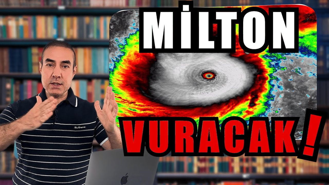
The Atlantic Is Literally Exploding With Activity...

Ryan Hall, Y'all
30 Sept 202412:00

Summary

TLDROn September 30th, 2024, the weather report discusses Hurricane Isaac's downgrade to a tropical storm, its path towards Europe, and potential impacts. Joyce weakens and poses no threat. A new system off Africa and Tropical Depression 12 are monitored, with the latter expected to become a major hurricane named Kirk. The Caribbean system is watched closely for Gulf Coast impacts. The Y'all Squad nonprofit aids in disaster relief, distributing supplies and Starlink panels for connectivity. The script also covers the upcoming weather patterns, including a potential severe weather season in October with snow in the Great Lakes region and a warm spell followed by a cold front.

Takeaways

  • 🌪️ Hurricane Isaac has been downgraded to a tropical storm and is expected to weaken as it heads towards Europe, potentially causing some rain and strong winds.
  • 🐟 Tropical Storm Joyce is weakening and curving out to sea, posing no immediate threat.
  • 🌍 A new system off the coast of Africa could develop into a new hurricane; it needs to be monitored closely.
  • 💥 Tropical Depression 12 is one of the most active and eastern storms for this time of year and could become a major hurricane.
  • 🌊 A system in the Caribbean could potentially turn into a tropical storm or hurricane in the Gulf of Mexico, impacting the Gulf Coast.
  • 🚚 Relief efforts by the Y'all Squad are ongoing, with supplies and communication tools being distributed to areas impacted by recent storms.
  • 🌧️ Heavy rain is expected for southern Alabama, Georgia, and the Florida Panhandle, but no major hurricane development is forecasted for the area.
  • ❄️ A major cold front from Canada is expected to impact the central US around mid-October, bringing cooler temperatures and potentially severe weather.
  • 📉 For the next week, most of the US will experience below-average rainfall, except for the coastal areas and the Appalachian Mountains.
  • 🌀 Tropical Storm Kirk has formed, and it's expected to become a powerful hurricane, but it will likely curve out to sea, minimizing its impact on land.

Q & A

  • What is the current status of Hurricane Isaac?

    -Hurricane Isaac has been downgraded to a tropical storm and is expected to weaken further as it heads toward Europe, potentially bringing rain and winds.

  • Is there any concern about Tropical Storm Joyce?

    -No, Tropical Storm Joyce is weakening and is expected to curve out to sea, posing no significant threat.

  • What new system has emerged near the coast of Africa?

    -A new system has come off the coast of Africa, which could develop into a hurricane in the main development region, requiring close monitoring.

  • Why is Tropical Depression 12 considered interesting?

    -Tropical Depression 12 is interesting because it's expected to become one of the most eastern storms of the season to develop into a major hurricane, likely becoming Category 3 or higher.

  • What is the status of the system in the Caribbean?

    -There is a system forming in the Caribbean, which may develop into a tropical system in the Gulf of Mexico. It's being closely monitored for potential impact on the Gulf Coast.

  • What efforts are being made by Y’all Squad to support affected areas?

    -Y’all Squad has raised a significant amount of money, dispatched a semi-truck full of supplies to Tennessee, and purchased Starlink panels to help people in affected areas stay connected.

  • What is the significance of the upcoming storm expected to be named Kirk?

    -The storm, expected to be named Kirk, is likely to become a major hurricane but is predicted to curve out to sea, causing little to no impact on land.

  • What weather conditions are expected in the Gulf of Mexico in early October?

    -There may be heavy rain and thunderstorms, especially around Florida's Panhandle, southern Alabama, and Mississippi, but no major hurricane is expected at this time.

  • What changes are expected in the weather pattern around mid-October?

    -A big weather change is expected from Canada around mid-October, bringing cooler temperatures and possibly snow in the Great Lakes region and severe weather outbreaks in the central U.S.

  • How will temperatures fluctuate in the U.S. in the coming weeks?

    -Temperatures will be well above average in the central U.S., but this will be followed by a significant cold front in mid-October, leading to a sharp drop in temperatures and potential severe weather.

Outlines

00:00

🌪️ Major Weather Updates: Hurricane Isaac and More

On September 30th, 2024, the focus is on multiple tropical systems, with Hurricane Isaac being downgraded to a tropical storm as it moves towards Europe. Despite weakening, it may still cause rain and wind. Joyce, another storm, is also weakening and curving out to sea. A new system has emerged off the coast of Africa, potentially becoming the next hurricane, while Tropical Depression 12 is stirring considerable activity in the Atlantic. There's growing concern about a developing system in the Caribbean, which may impact the Gulf of Mexico. The Y'all Squad has also been actively supporting disaster relief, sending supplies and Starlink panels to areas impacted by recent storms, like Tennessee and Asheville, NC. They're providing connectivity to regions that may be without power for months.

05:06

🌬️ Monitoring Tropical Depression 12 and Hurricane Kirk

Tropical Depression 12 is predicted to become a major hurricane, possibly named Kirk. This system is one of the most eastern storms to form this late in the season and is expected to become a Category 3 or higher. Fortunately, it's currently forecasted to curve out to sea, with minimal impact on land. Future updates will monitor any changes in trajectory. While the storm is fascinating from a meteorological perspective, it's unlikely to affect Bermuda or coastal areas. As of the editing of this video, Tropical Storm Kirk has officially formed and is likely to intensify into Hurricane Kirk soon.

10:08

🌧️ Gulf of Mexico Weather: Rain and Potential Flash Flooding

Attention shifts to the Gulf of Mexico, where a system linked to the Central American monsoon is brewing. While development remains uncertain, this system is likely to bring moisture to coastal regions, causing daily downpours and potential flash flooding in Florida, southern Louisiana, Mississippi, Alabama, and southeastern Texas. The forecast shows development by October 7th, with the possibility of heavy thunderstorms and rain, but not a major hurricane. The host emphasizes the importance of staying alert, even if the current model predictions don't indicate a severe threat.

⚡ Cold Air and Severe Weather Risks Ahead

After dealing with the current Gulf system, there’s a significant weather change forecasted from Canada. A major cold front will bring shots of cold air into the U.S. by mid-October, potentially leading to snowfall in the Great Lakes region as early as October 14th. The collision of cool air from the Rockies and warm air to the east could trigger severe weather outbreaks in the central U.S. during the latter half of October. The Climate Prediction Center is also noting upcoming weather patterns, predicting above-average temperatures for most regions, followed by a significant cool-down.

❄️ Upcoming Weather Patterns: Warm to Cold Shift

The weather pattern will flip after a week of above-average temperatures, transitioning into a cooler period in mid-October. The western U.S. will see a warm ridge, pushing temperatures 30-40 degrees above average in some areas like Nebraska and Kansas. However, a strong cold front will follow, erasing the warm air and bringing cooler-than-normal temperatures. This shift is expected to spark more severe weather outbreaks and mark the beginning of fall's battleground between warm and cold air masses.

☔ Rainfall Forecast and Continued Y'all Squad Efforts

The rainfall forecast for the next seven days shows low rain levels across most of the U.S., except for coastal areas in the Gulf of Mexico, where some places might experience up to 10 inches of rain. The Appalachian Mountains could also see additional rainfall, but no major flooding is anticipated. Updates on the Caribbean system will be provided daily, with the Y'all Squad continuing to assist affected areas by sending supplies and Starlink units. Their ongoing efforts, supported by donations, are aimed at helping communities that may be without power, water, or internet for months.

Mindmap

Keywords

💡Hurricane Isaac

Hurricane Isaac is a tropical storm mentioned in the video, initially downgraded from hurricane status. It's significant to the video’s theme of storm tracking and weather updates, as it heads toward Europe. Though weakening, Isaac still poses a risk of rain and wind, illustrating the ongoing concern with weather impacts from tropical systems.

💡Tropical Depression 12

Tropical Depression 12 is identified as an interesting weather development in the Atlantic. The speaker mentions its potential to become a major hurricane, likely curving out to sea without impacting land. It underscores the video’s focus on predicting and analyzing significant weather patterns, especially during an unusually active hurricane season.

💡Gulf of Mexico

The Gulf of Mexico is referenced as an area where tropical activity is building, with concerns about the formation of a new system. This location is critical for the video’s discussion of potential impacts on the U.S. Gulf Coast, including rain and flooding risks. The Gulf frequently serves as a hotspot for tropical storm and hurricane development.

💡Central American monsoon

The Central American monsoon is a weather system contributing moisture to the Gulf of Mexico, leading to potential tropical development. It exemplifies the complex interactions of regional weather patterns, playing a role in forming storms that could affect coastal regions with heavy rainfall and thunderstorms.

💡Starlink panels

Starlink panels are part of the relief efforts mentioned in the video, with the speaker highlighting the deployment of these satellite internet systems to maintain communication during disaster recovery. This concept reflects the speaker's focus on both weather updates and ongoing support for communities affected by severe weather, ensuring connectivity in isolated areas.

💡Caribbean system

The Caribbean system refers to a weather disturbance in the Caribbean Sea, which has the potential to develop into a tropical storm. The speaker tracks its progression, discussing potential rainfall and flooding impacts, particularly along the Gulf Coast. This system is central to the video’s ongoing weather updates and warnings for coastal regions.

💡Tropical Storm Kirk

Tropical Storm Kirk is expected to become a major hurricane in the Atlantic Ocean. Its formation highlights the unusually active hurricane season. The storm is predicted to remain out at sea, posing little threat to land, but it is notable for potentially being one of the strongest hurricanes of the season, reflecting the speaker’s focus on storm monitoring.

💡Flooding

Flooding is a recurring concern throughout the video, particularly in regions like southern Louisiana, Alabama, and Florida. The speaker warns about heavy rainfall from various tropical systems and the potential for flash flooding, especially in already saturated areas. Flooding is a significant hazard related to tropical weather systems.

💡GFS model

The GFS (Global Forecast System) model is a weather prediction tool referenced in the video. The speaker uses this model to project wind speeds and storm development, particularly for tracking the progression of storms like Tropical Depression 12 and potential systems in the Gulf of Mexico. It serves as a key tool for analyzing storm intensity and trajectory.

💡Severe weather

Severe weather, including storms and potential cold fronts, is a major theme of the video. The speaker discusses the possibility of severe weather outbreaks as cold air from Canada interacts with warm air in the U.S., leading to storms. The mention of severe weather connects to both tropical systems and the broader discussion of fall and winter weather patterns.

Highlights

Hurricane Isaac has been downgraded to a tropical storm as it weakens while moving towards Europe, potentially causing rain and winds.

Tropical Storm Joyce is weakening and curving out to sea, posing no threat as a 'fish storm'.

A new system off the coast of Africa could develop into a hurricane in the main development region of the Atlantic.

Tropical Depression 12 is being closely monitored due to its potential to become a major hurricane.

Another system in the Caribbean could develop into a tropical system and head towards the Gulf of Mexico.

Y'all Squad has raised significant funds and is distributing supplies to hurricane-impacted areas in Tennessee.

Chandra from Y'all Squad has acquired Starlink panels to provide connectivity to shelters in Asheville, North Carolina.

Tropical Depression 12 could become Hurricane Kirk, possibly a Category 3 hurricane, though it is expected to curve out to sea.

A Gulf of Mexico system could bring heavy rains and thunderstorms to the Panhandle of Florida and coastal areas, but is not expected to become a major hurricane.

Severe weather outbreaks are expected in the central U.S. in mid-October, with temperature swings causing storm activity.

Temperatures are expected to rise 30 to 40 degrees above average in the central U.S., before a major cool air plunge hits.

Cool air from Canada is expected to bring cold fronts to the Great Lakes, with possible snow as early as October 14th.

The central U.S. could experience severe weather from temperature contrasts between warm and cool air masses in mid-October.

Rainfall over the next seven days will mostly affect coastal areas of the Gulf of Mexico and the Appalachian Mountains.

Y'all Squad continues to provide support in hurricane-hit areas, sending supplies and Starlinks to those in need.

Transcripts

play00:00

It's September 30th, 2024, and we've got some  major developments here with the weather. We're  

play00:06

going to talk about the tropics first. Of  course, we've got Hurricane Isaac, which has  

play00:10

been downgraded to a tropical storm. It's going to  continue to weaken as it heads up towards Europe,  

play00:14

but it still might cause some problems in terms  of rain and some decent winds. We've got Joyce out  

play00:19

there also weakening a little bit. It's going to  curve out to sea. It's a little fish storm. We're  

play00:24

not worried about it. We've got another system  that has kind of come off of the coast of Africa  

play00:28

that could turn into our next hurricane out here  in the main development region that we've got to  

play00:32

keep an eye on. And Tropical Depression 12 looks  very interesting. We've got a literal explosion  

play00:38

of activity out here in the Atlantic as this is  the most active that we have seen it so far. And  

play00:43

of course all eyes are on our next system down  here in the Caribbean which is unfortunately  

play00:47

going to become another system in the Gulf of  Mexico that we have to watch very closely for  

play00:52

our friends along the Gulf Coast. But before we  get into that I want to say thank you everybody  

play00:58

yesterday that went over to theyallsquad.org and  made a donation. We've raised a significant amount  

play01:03

of money and we are in contact now with a lot  of emergency officials all up and down the East  

play01:08

Coast in Florida, Georgia, South Carolina, North  Carolina and Tennessee. And we are already on  

play01:13

the ground helping. We've got a semi truck full of  supplies twenty to forty thousand dollars worth of  

play01:18

supplies already out there on its way to Tennessee  where we're gonna then distribute it out to other  

play01:23

places. All that's coming from our warehouse in  Iowa, the Y'all Squad headquarters. Additionally,  

play01:29

Chandra yesterday went to West Virginia and  bought literally every Starlink panel in West  

play01:34

Virginia and today she's getting on a plane  and taking those to Asheville, North Carolina,  

play01:39

giving them to the local officials so that they  can set up reference points to communicate with  

play01:43

each other and of course give people at shelters  and in different places like that the ability to  

play01:47

connect with the outside world because people are  still in the dark out here and it might be months  

play01:52

before these people get water, power, or internet.  So we're doing everything we can to provide a  

play01:57

little bit of connectivity for them. And once  again, we wouldn't be able to do that or anything  

play02:00

else that we're going to do without you going over  to theyallsquad.org and making that tax-deductible  

play02:06

donation to our 501c3 nonprofit organization.  Thank you so much for giving us this opportunity.  

play02:11

But of course, we do have to keep looking into  the future. And once again, I said Tropical  

play02:15

Depression 12 was looking quite interesting, and  it's because this is going to end up being one of  

play02:20

the most eastern storms to ever form this time of  year that actually becomes a major hurricane. This  

play02:26

is going to become a Cat 3 or higher as it goes  to the west. The good news right now is that the  

play02:31

path doesn't look to impact anyone. It looks like  this is gonna curve out to sea. It might not even  

play02:36

cause any problems for Bermuda. So we are really  hoping that this is gonna be a big-time fish storm  

play02:41

and we don't have to worry about anything but  of course we're gonna be monitoring it here and  

play02:45

if there's any sort of westward shifts, then we  will be the first to let you know. But right now,  

play02:50

this is not something that we need to be worrying  about. If we come over to the GFS model and watch  

play02:54

it blow up on the 500 millibar wind speeds though,  it is pretty cool to look at. This is going to be  

play03:01

a powerful hurricane more than likely, and it's  going to be named Kirk as long as it's the next  

play03:05

one to get a name. Hurricane Kirk will likely  be one of the strongest hurricanes of this time  

play03:10

of year this far east. So just another interesting  tidbit about how unusual this hurricane season has  

play03:16

been. We knew that it was going to be very active.  We knew that the waters out there were incredibly  

play03:21

warm and conducive for hurricane formation. And  now we're really starting to see that as we enter  

play03:26

the latter part of the season. But the good news  is, is it's out of here. Okay, it's going to go  

play03:31

out to sea more than likely. There's another storm  right behind it, but it looks like it's going to  

play03:35

follow the same path. So hopefully we don't have  to talk too much more about those storms. Notice  

play03:39

how there's not any big hurricanes over here in  the Gulf despite that system in the Caribbean that  

play03:44

is forming. Hello Future Ryan here. Listen,  we called it. All right, we said it's gonna  

play03:49

become Kirk and as we're editing this video it has  become Kirk so nothing much has changed about the  

play03:54

path or trajectory or the expected strength. We  still think this is gonna be a major hurricane.  

play03:59

It still looks like it's gonna go out to sea but  it is officially Tropical Storm Kirk and it'll  

play04:03

be Hurricane Kirk very soon now. Now let's get  back to the present or the past. Let's go take  

play04:07

a closer look at this. Look at all that moisture  down there in the Gulf of Mexico. This is a result  

play04:12

of the Central American monsoon and if enough of  that energy makes it over the Gulf of Mexico for  

play04:17

any amount of time, it is going to start spinning  and it's going to become some sort of tropical  

play04:21

system. Now in the meantime, what this is going  to do is it's just going to send a lot of moisture  

play04:26

up along the coastal areas. So we do have to worry  about daily downpours in the peninsula of Florida,  

play04:31

maybe some flash flooding concerns in southern  Louisiana, Mississippi, Alabama, and the Panhandle  

play04:35

of Florida, maybe even in southeast Texas as well.  So as I continue to push this forward, watch how  

play04:40

there is finally some sort of development here in  the Gulf of Mexico as we get into Monday, October  

play04:45

7th. And right now it's just that, a little bit of  a development, some strong thunderstorms and some  

play04:50

heavy rain possible in the Panhandle according  to this model, but that's pretty much it. It  

play04:55

does send a little bit of unneeded rainfall  up into the Appalachian Mountains, but nothing  

play04:59

crazy. Okay, right now the GFS is showing a pretty  typical tropical system kind of just bringing  

play05:06

some thunderstorms and rain into the area. It's  not showing a major hurricane. It's not showing  

play05:10

anything like that. However, anytime we get a  storm in this part of the Gulf of Mexico this  

play05:15

time of year we have to take it seriously and we  have to watch it. Nobody should be scared of this  

play05:19

thing. Nobody should be concerned. If that changes  I'll be the first to let you know. But right  

play05:24

now things are looking quite tame with our next  system. It could change. But right now, let's just  

play05:31

not ring the alarm bells just yet. Go ahead and  prepare for potentially a pretty heavy rainstorm,  

play05:37

especially in the extreme southern areas  there in southern Alabama, southwest Georgia,  

play05:40

and the Panhandle of Florida. But outside of that,  let's just hope for the best. Now after we're done  

play05:45

dealing with this system, and we'll have a lot  more updates on that in the coming days, there's  

play05:50

another really interesting thing that's going to  happen as there's a pretty big change coming from  

play05:54

Canada. And we'll talk about that right after we  shout out today's awesome sponsor. Factor meals  

play05:59

healthy eating made easy. Storm season is getting  plum wild and when I'm constantly making videos,  

play06:05

writing scripts, prepping for a live stream,  fixing broken computers, meal planning is the last  

play06:10

thing on my mind. There's a million things going  on, why do we got to think about cooking food?  

play06:14

Well that's where Factor comes in. Factor delivers  fresh, never frozen, dietician approved meals  

play06:20

right to your doorstep and they're just ready to  go. Everything's already stressful enough, why do  

play06:24

we got to worry about food too? Well Factor takes  the stress out of meal planning. With over 35  

play06:29

meal options, including keto, calorie smart, and  even vegan and veggie meals, we can always fuel  

play06:36

up without missing a beat. In just 2 minutes, you  can have yourself a chef-created meal ready to go.  

play06:42

Right now, you can get 50% off your first Factor  Box and 20% off your next month of meals. All you  

play06:49

gotta do is click that link in the description. Or  go over to Factor75.com right now and use the code  

play06:56

HALLYALL50. Use that code over at Factor75.com  and trust me, it's worth it. Thank you so much,  

play07:02

Factor, for sponsoring the video. It helps  us out. Let's get back into the video. Okay,  

play07:06

super huge shout out to them for sponsoring the  video. It's always a good thing whenever we have  

play07:10

a sponsor here. So yeah, look at all this rain  coming up into the coastal areas of the Gulf. This  

play07:15

is associated with our next tropical system. This  is showing a weak tropical depression at most,  

play07:20

not a hurricane. There's a chance that it could be  stronger than that, but we're hoping for the best  

play07:24

here. And we're not we're not creating any sort of  hype around the fact this could be the next Helene  

play07:28

because no it won't don't be scared. Be prepared.  I will let you know if there's any changes there.  

play07:34

Now once we're done with that there's gonna  be some lingering rain in the Southeast and  

play07:38

unfortunately this might add a little bit of some  problems to the flooded areas especially where  

play07:42

the ground still super saturated, but I don't see  any major flooding concerns associated with this  

play07:47

leftover rain here. It's just something that we  need to watch for maybe some additional flooding  

play07:51

problems. But the rest of us are gonna be in a  really quiet pattern for the next week or so. It's  

play07:56

not gonna be doing much of anything at all. We are  gonna start to see a little bit of a ridge form in  

play08:00

the West which is gonna make things quite warmer.  But for the most part severe weather is off the  

play08:05

table at least until we get that big looming  threat from Canada that I was talking about  

play08:10

before the break. This is essentially just gonna  be a couple shots of cold air winter is really  

play08:15

trying to show up. We are in that classic fall  battleground where we get these big troughs coming  

play08:20

in. It looks like that's going to start around the  middle of October. And what that's going to bring  

play08:24

about is potentially some snow. OK, we're going  to really have to talk about snow up here in the  

play08:29

Great Lakes region as early as October 14th. And  it's going to bring about another severe weather  

play08:35

season. As these big shots of cool air come into  the Rockies and meet up with the warm air that's  

play08:40

forming out east in the middle, we have to worry  about severe weather. And I think that we're  

play08:44

actually going to have quite a few severe weather  outbreaks towards the middle and latter half of  

play08:49

October. You can see that temperature swing here  very obviously. First of all, look at that ridge  

play08:54

forming in the West. That's going to send a pretty  big plume of very warm air into the central U.S.  

play09:02

as we go into the latter part of this weekend and  early next week. It's going to be potentially 30  

play09:07

to 40 degrees above average in Nebraska, Kansas,  and Minnesota. So you're not gonna believe me next  

play09:12

week when I say there's a huge shot of winter and  cool air coming in. But it is gonna be coming in.  

play09:17

It's gonna be quite warm and then that's gonna  set the stage for our next big shot of cold air.  

play09:21

There's a little one that comes in for the  Great Lakes as we go into the October 10th  

play09:26

time period. But watch what happens after that  a huge erasing of all that warm air happens as  

play09:32

a huge plume of much cooler air actually converts  those above averages to below average temperatures  

play09:38

in the central US and this is the kind of system I  think that will be responsible for sparking severe  

play09:43

weather outbreaks as we go deeper into October and  we're gonna get several different opportunities  

play09:48

here. Look at this. This is a stark difference  between the very cool air and the very warm  

play09:52

air on October 16th. This is another system that  could bring about some severe weather here in the  

play09:57

central US so we're gonna be watching that very  very closely. The Climate Prediction Center is  

play10:03

seeing a of the same stuff. Okay, we've got above  average temperatures over the next 6 to 10 days.  

play10:08

We're near normal on the East Coast. This is going  to flip. This is going to flip whenever we see  

play10:13

that big pattern change and we start to see those  cool crashes of air coming down into the Rockies.  

play10:19

That happens after 10 days though, so keep  that in mind. From now until 10 days from now,  

play10:23

this is what we're talking about and then we're  going to flip it a little bit as we go deeper  

play10:26

into October. Additionally, this is how much rain  we're expected to see over the next seven days  

play10:31

and this is abysmally low for the vast majority  of the United States, but notice those coastal  

play10:36

areas we are looking at. If you're really close  to the ocean here in the Gulf of Mexico, some  

play10:41

places could see three, four inches of rain. Some  places in the peninsula of Florida could see seven  

play10:47

to 10 inches of rain over the next seven days. So  it's going to be very rainy down there. Everybody  

play10:51

else is not going to be seeing much rain at all,  except for over here in the Appalachian Mountains  

play10:55

where we could see some additional rainfall of  around an inch or two over the next seven days,  

play11:00

which might cause a little bit of problems, but  for the most part shouldn't be too much to worry  

play11:05

about. And of course as we get updated data on  our system in the Caribbean, I'm gonna keep you  

play11:10

updated here. There's a chance that I make a video  almost every day this week. If not for updating  

play11:15

you on the Caribbean system, then at least every  couple of days I'm gonna update you on what we're  

play11:20

doing with the Y'all Squad and continue to update  you on this big weather pattern shift that we're  

play11:24

getting ready to have. So hopefully that's the  I would really hate to come back here tomorrow  

play11:29

or the next day and be like, ah, the GFS is  showing a big hurricane now. That's very unlikely,  

play11:34

but we are rooting against that. So once again,  thank you to Factor for sponsoring this video.  

play11:38

It's very awesome. And also thank you guys for  going over to theyallsquad.org. We're doing big  

play11:43

things and we're gonna continue to do big things  for this foreseeable future in this area. However  

play11:47

long we're needed we're gonna be continuing to  send trucks and people and Starlinks. Whatever  

play11:51

else is needed and we're going to be down there,  thanks to y'all. And that's all the weather  

play11:55

talk I have for you today. Thank you so much.  I'll see you in the next one. Goodbye. Whoop!

Rate This

5.0 / 5 (0 votes)

Ähnliche Tags
Hurricane KirkTropical StormsWeather UpdateRelief EffortsGulf CoastFloodingEmergency AidStorm MonitoringCaribbean SystemSevere Weather
Benötigen Sie eine Zusammenfassung auf Englisch?