Kelas 6 Tema 1: Kondisi Geografis Negara-Negara di Asia Tenggara | IPS : KD 3.1/4.1
Summary
TLDRThis educational video by Teacher Dinda introduces sixth-grade students to the geographical conditions of Southeast Asian countries. It explains the concept of geographical conditions, including location, climate, landforms, and natural features, and provides an overview of ASEAN—its formation, objectives, and member states. The lesson explores Southeast Asia’s astronomical and geographical position, tropical climate, and natural landscapes. Each country is discussed in terms of land area, physical features, climate, agriculture, and ethnic groups, including Indonesia, Malaysia, Brunei, Singapore, Cambodia, Laos, Myanmar, the Philippines, Thailand, Vietnam, and Timor-Leste. The video concludes by highlighting regional similarities, national boundaries, and key comparisons.
Takeaways
- 😀 Southeast Asia is home to 11 countries, including Indonesia, Malaysia, Singapore, Philippines, Thailand, Brunei Darussalam, Vietnam, Laos, Myanmar, Cambodia, and Timor Leste, with 10 of them part of the ASEAN organization.
- 😀 ASEAN was established on August 8, 1967, through the Bangkok Declaration, and its founding members include Indonesia, Malaysia, Thailand, the Philippines, and Singapore.
- 😀 The main goals of ASEAN are to foster economic growth, enhance regional peace and stability, support education and agriculture, and improve political and security conditions within Southeast Asia.
- 😀 Southeast Asia lies between the Indian and Pacific Oceans and spans two continents: Asia and Australia. The region's climate is tropical due to its proximity to the equator.
- 😀 Southeast Asia's geography consists of peninsulas and archipelagos, featuring mountains, volcanoes, rivers, hills, and lakes.
- 😀 Indonesia, as a maritime nation with over 17,000 islands, has diverse geographical features and cultures. It is a leading agrarian country with a large variety of ethnic groups.
- 😀 Malaysia has two parts: West Malaysia, which is mainly lowland with mountain ranges, and East Malaysia, which is mountainous and forested. It is also an agrarian nation, though its agriculture is less extensive than other Southeast Asian countries.
- 😀 Brunei Darussalam is a small country located on the northern coast of Borneo, with flat lowlands and swampy areas that are less suitable for agriculture. The majority of its population is Malay.
- 😀 Singapore, a small island nation, has expanded its territory through reclamation. It has a low-lying landscape and is known for its urbanization and industrialization.
- 😀 The geographical layout of Southeast Asia allows for rich agricultural activities, with countries like Thailand, Vietnam, and Cambodia being known for their fertile lands and strong agricultural sectors.
- 😀 Timor Leste, the newest nation in Southeast Asia, was once a province of Indonesia and remains the only country in the region not yet a member of ASEAN due to its unpreparedness for joining the organization.
Q & A
What is the definition of geographical conditions as explained in the video?
-Geographical conditions refer to the state of a region, particularly in relation to its geographical aspects like location, area, relief, climate, soil types, and other natural features.
What is ASEAN, and which countries are part of it?
-ASEAN stands for the Association of Southeast Asian Nations. It includes 10 countries: Indonesia, Malaysia, Singapore, the Philippines, Thailand, Brunei Darussalam, Vietnam, Laos, Myanmar, and Cambodia. Timor Leste is not yet a member.
What was the purpose of establishing ASEAN?
-The main purposes of ASEAN include accelerating economic, social, and cultural growth in Southeast Asia, improving regional peace and stability, providing educational, industrial, and agricultural assistance, and enhancing political stability.
Why isn't Timor Leste part of ASEAN yet?
-Timor Leste has not yet joined ASEAN because it is not fully prepared to meet the organization’s criteria.
What is the significance of the equator to Southeast Asia?
-Southeast Asia is located along the equator, which gives the region a tropical climate, characterized by warm temperatures and seasonal rainfall.
What are the main geographical features of Indonesia?
-Indonesia is an archipelagic country with over 17,000 islands. Its geographical features include a vast oceanic expanse, mountains, and several large islands such as Java, Sumatra, Kalimantan, Sulawesi, and Papua.
What distinguishes Malaysia's geography from Indonesia's?
-Malaysia consists of two regions: Malaysia Barat (West Malaysia) and Malaysia Timur (East Malaysia). West Malaysia is mostly lowland with mountain ranges, while East Malaysia is characterized by hilly terrain and dense forests.
How does the geography of Brunei Darussalam affect its agriculture?
-Brunei's geography, with its lowlands and wetlands, is less suited for agriculture. Its land is not very fertile, especially in the western region, making large-scale farming challenging.
What makes Singapore's geography unique among Southeast Asian countries?
-Singapore is a small city-state with limited land area. Its geography is primarily flat, and due to its size, the country has engaged in land reclamation projects to increase its usable land area.
Why is Thailand considered a major agricultural country in Southeast Asia?
-Thailand is known for its fertile lowlands and abundant water resources, particularly from rivers like the Chao Phraya. This makes the country ideal for farming, particularly rice cultivation.
Outlines

هذا القسم متوفر فقط للمشتركين. يرجى الترقية للوصول إلى هذه الميزة.
قم بالترقية الآنMindmap

هذا القسم متوفر فقط للمشتركين. يرجى الترقية للوصول إلى هذه الميزة.
قم بالترقية الآنKeywords

هذا القسم متوفر فقط للمشتركين. يرجى الترقية للوصول إلى هذه الميزة.
قم بالترقية الآنHighlights

هذا القسم متوفر فقط للمشتركين. يرجى الترقية للوصول إلى هذه الميزة.
قم بالترقية الآنTranscripts

هذا القسم متوفر فقط للمشتركين. يرجى الترقية للوصول إلى هذه الميزة.
قم بالترقية الآنتصفح المزيد من مقاطع الفيديو ذات الصلة

Stand for Truth: Mga Pinoy, nahuhuli na nga ba sa edukasyon?

HEOGRAPIYANG PISIKAL NG TIMOG-SILANGANG ASYA (MATATAG) #matatagcurriculum

Nadiem Akan Wajibkan Pelajaran Bahasa Inggris di Sekolah, Ini Alasannya
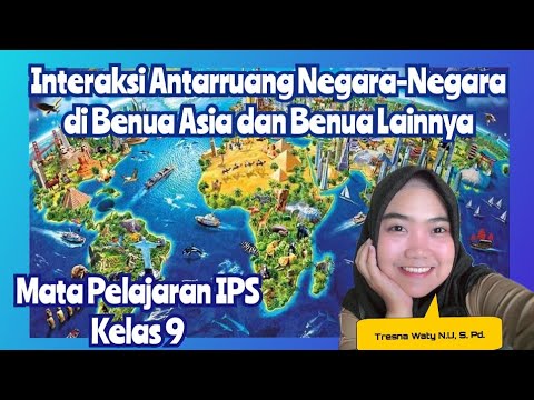
Interaksi Antarruang Negara-Negara di Benua Asia dan di Benua Lainnya||Mapel IPS||Kelas 9- Part 1

حصص الصف السادس | اللغة الإنجليزية - تمارين عامة | أ. عامر ترجوك

Angles, Geometrical Figure, Class 4 Math, Student point academy, Maharashtra Board
5.0 / 5 (0 votes)
