GEO 1 5 FIN

EDUTECH SDHSLH
17 Oct 202308:26

Summary

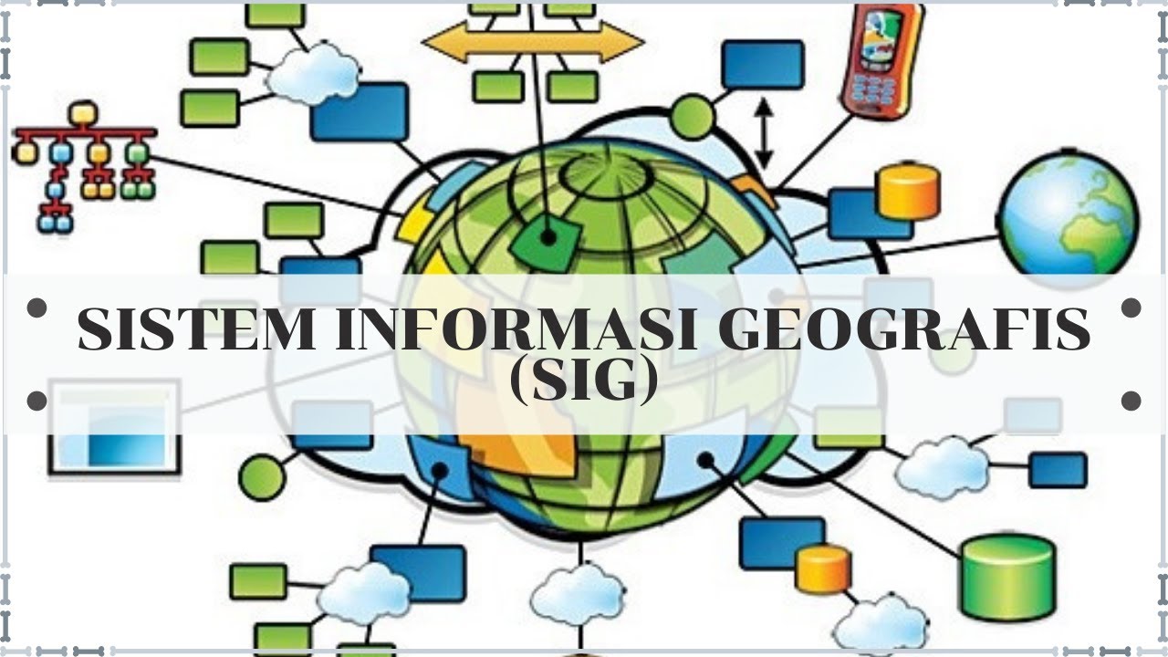
TLDRThis script discusses Geographic Information Systems (GIS), explaining how they integrate spatial data with software and hardware to solve complex problems. It covers the components of GIS, including hardware like GPS and digitizers, software for data processing, and the experts involved. It also explains the classification of data into spatial and non-spatial, and the types of spatial data like vector and raster. The script further delves into methods and procedures used in GIS for data processing, such as buffering, scoring, and overlay, which are crucial for generating new insights from spatial data.

Takeaways

  • 🌐 **Geographic Information Systems (GIS)** are used in apps like Gojek and Grab for spatial data management.
  • 📚 **Definition of GIS**: A system designed to integrate data with spatial reference coordinates and graphical coordinates.
  • 💻 **Components of GIS**: Include hardware, software, and procedures to manage, analyze, and model complex spatial problems.
  • 🖥️ **Hardware in GIS**: Can range from PCs to specialized devices like digitizers, CD rooms for data storage, and printers or plotters for output.
  • 🛠️ **Software in GIS**: Tools used for data processing, with examples like Quantum GIS, which can be free or paid.
  • 🧠 **Human Expertise (Brainware)**: Involves operators, analysts, programmers, and administrators who work with GIS.
  • 🗺️ **Data Classification in GIS**: Divided into spatial data (with positional value) and non-spatial data.
  • 📊 **Types of Spatial Data**: Vector data stored as coordinates and raster data composed of cells or pixels.
  • 🔍 **Methods in GIS**: Include procedures for data processing like summation, classification, overlay, and geometric correction.
  • 🔄 **Subsystems of GIS**: Include data input, management, manipulation and analysis, and output, each serving a specific function in the GIS workflow.
  • 📈 **Data Manipulation**: Involves creating new maps through processes like buffering, scoring, and overlaying to derive new insights from spatial data.

Q & A

  • What is a Geographic Information System (SIGIG)?

    -SIGIG is a system designed to integrate data with reference to spatial coordinates and graphical coordinates, supporting the acquisition, management, manipulation, analysis, modeling, and presentation of spatial data for complex problem-solving.

  • What are the components of SIGIG?

    -SIGIG consists of hardware, software, and procedures. Hardware includes devices like PCs, laptops, CD rooms, digitizers, scanners, printers, and plotters. Software is used for data processing, with examples like Quantum GIS. Procedures involve steps for data processing.

  • What is the role of hardware in SIGIG?

    -Hardware in SIGIG serves as the physical devices needed for data storage, digitization, printing, and location determination, such as computers, CD rooms for data storage, digitizers for converting analog data to vector data, scanners for raster data, printers for small outputs, and plotters for large prints, as well as GPS for location determination.

  • Can you explain the software aspect of SIGIG?

    -SIGIG software processes data. It can be either paid or free. An example of free software is Quantum GIS, which is used for managing and analyzing spatial data.

  • Who are the professionals involved in SIGIG?

    -SIGIG involves professionals such as operators, analysts, programmers, administrators, and others who are all part of the SIGIG ecosystem.

  • What are the types of data used in SIGIG?

    -SIGIG uses two types of data: spatial and non-spatial. Spatial data has positional values and often includes location on Earth's surface, while non-spatial data does not have positional values.

  • How is spatial data categorized in SIGIG?

    -Spatial data in SIGIG is categorized into vector and raster data. Vector data is stored in coordinate arrangements, forming points, lines, or polygons. Raster data consists of grid cells or pixels.

  • What are the methods or procedures used in SIGIG for data processing?

    -Methods in SIGIG include procedures such as summation, classification, rotation, overlay, buffering, and geometric correction to process data into information.

  • What is the role of the input subsystem in SIGIG?

    -The input subsystem in SIGIG is responsible for collecting spatial and attribute data, which can come from sources like analog maps, aerial photos, satellite images, field measurements, and GPS data.

  • What happens in the data management subsystem of SIGIG?

    -The data management subsystem organizes spatial and attribute data into a database, making it easy to retrieve, update, and edit.

  • How is new map creation described in the SIGIG process?

    -New map creation in SIGIG involves the data manipulation and analysis subsystem, where new maps are formed through manual or computerized processes after data has been processed.

  • What is the purpose of the output subsystem in SIGIG?

    -The output subsystem in SIGIG is responsible for displaying or producing all or part of the database in soft copy or hard copy forms, such as tables, graphs, new maps, etc.

  • How does the overlay process work in SIGIG?

    -The overlay process in SIGIG involves combining or superimposing maps to obtain new graphical data with a single mapping unit, which can reveal new insights or information.

Outlines

00:00

🌐 Introduction to Geographic Information Systems

The script introduces the concept of Geographic Information Systems (GIS), explaining that when ordering services like online transportation or food delivery, spatial data is being utilized. It defines GIS as a system designed to integrate data with spatial reference coordinates and graphical coordinates. The script elaborates on the components of a GIS, which include hardware (like PCs, CD rooms, digitizers, scanners, printers, plotters, and GPS devices), software (both paid and free, with Quantum GIS as an example), and human expertise (operators, analysts, programmers, administrators, etc.). It also discusses the types of data used in GIS, differentiating between spatial data (which has positional value and can be geographically referenced) and non-spatial data. The script further explains the two types of spatial data: vector data (stored as coordinates and can form lines or polygons) and raster data (composed of cells or pixels).

05:03

🛠️ GIS Data Processing and Analysis Techniques

This paragraph delves into the methods used to process data into information within a GIS, such as summation, classification, rotation, overlay, and geometric correction. It emphasizes that the methods applied in GIS vary depending on the problem at hand. The paragraph outlines the subsystems of a GIS, including data input (collecting spatial and attribute data from sources like analog maps, aerial photos, satellite images, field measurements, and GPS data), data management (organizing spatial and attribute data into a database for easy access and editing), data manipulation and analysis (creating new maps through processes like buffering, scoring, and overlay), and data output (displaying or producing data in various forms such as soft copy or hard copy like tables, graphs, and new maps). The script provides examples of how these processes are applied, such as scoring to assess flood risks based on proximity to rivers and using overlay to combine maps to obtain new graphical data with mapping units.

Mindmap

Keywords

💡Sistem Informasi Geografis

Sistem Informasi Geografis (SIG) is a system designed to capture, store, manipulate, analyze, manage, and present geospatial data. In the context of the video, SIG is the central theme as it discusses how these systems are utilized in various applications such as online ojek booking and food delivery apps. The script mentions that SIG involves managing spatial data through various procedures and components, highlighting its importance in modern services.

💡Data Spasial

Data Spasial refers to data that has a geographic or spatial reference, meaning it is associated with a specific location. The video script explains that spatial data can be categorized into vector and raster data types. It is integral to SIG as it forms the basis for mapping and geographical analysis, such as in the case of GPS data used for location tracking.

💡Data Nonspasial

Data Nonspasial, as mentioned in the script, is data that does not have a geographic position value. Despite not having a spatial reference, nonspatial data is crucial for SIG as it often provides context or attributes to spatial data. For example, demographic information about a region might be nonspatial but is essential for comprehensive geographical analysis.

💡Hardware

Hardware in the context of SIG includes the physical components used in the system, such as PCs, laptops, CD rooms for data storage, digitizers for converting analog data to vector format, scanners that produce raster data, printers, and plotters for outputting maps. The script emphasizes the importance of these physical devices in the functioning of SIG.

💡Software

Software in SIG refers to the programs or applications used to process and analyze geospatial data. The script gives an example of free software like Quantum GIS, which is used for tasks such as data manipulation and analysis. Software is a critical component of SIG as it enables users to interact with and derive insights from spatial data.

💡Ahli

Ahli, or experts, in the context of the video, refers to professionals such as operators, analysts, programmers, and administrators who work with SIG. These experts are essential for the effective use and management of SIG, as they possess the skills to handle the complex tasks involved in geospatial data processing.

💡Data Vector

Data Vector is a type of spatial data that is stored as coordinates in the form of points, which can be connected to form lines or polygons. The script explains that vector data is useful for creating precise maps and geographical features. It is contrasted with raster data in the discussion of different data types within SIG.

💡Data Raster

Data Raster consists of elements arranged in a grid of cells or pixels, which is another form of spatial data representation. The video script mentions that raster data is used when the precision of vector data is not necessary, such as in satellite imagery or aerial photos, where data is represented in a continuous tone.

💡Metode

Metode, or methods, in SIG refer to the procedures used to process data into information. The script lists methods such as addition, classification, rotation, overlay, and geometric correction. These methods are essential for transforming raw spatial data into actionable insights, which is a key aspect of the SIG's utility.

💡Subsistem

Subsistem, or subsystems, in SIG are the individual components that work together to form the complete system. The script outlines various subsystems such as data input, data management, data manipulation and analysis, and data output. Each subsystem plays a specific role in the overall function of SIG, contributing to the system's ability to process and present geospatial information.

💡Overlay

Overlay in the context of the video is a method used in SIG to combine or superimpose maps to obtain new graphical data with a single mapping unit. It is an example of how different layers of spatial data can be merged to reveal new insights or information, such as combining land use and population data to analyze urban development.

Highlights

Sistem informasi geografis (SIG) digunakan dalam aplikasi seperti Gojek, Grab, dan Shopee Foodgood.

SIG menjual data spasial melalui sistem informasi geografis.

Definisi SIG adalah suatu sistem informasi yang terintegrasi dengan data referensi berbasis data koordinat ruang dan koordinat grafis.

SIG terdiri atas perangkat keras, perangkat lunak, dan prosedur.

Perangkat keras SIG mencakup PC, laptop, CD room, digitizer, scanner, printer, dan plotter.

Perangkat lunak SIG digunakan untuk mengolah data dan terdapat pilihan yang berbayar maupun gratis.

Brainware dalam SIG meliputi ahli seperti operator, analis, programmer, administrator, dan lainnya.

Data dalam SIG dibagi menjadi data spasial dan data nonspasial.

Data spasial memiliki nilai posisi dan referensi geografis.

Data nonspasial tidak memiliki nilai posisi.

Data spasial dapat dikelompokkan menjadi data vektor dan data raster.

Data vektor disimpan dalam susunan koordinat x dan y.

Data raster terdiri dari elemen berbentuk sel atau piksel.

Metode dalam SIG meliputi penjumlahan, klasifikasi, rotasi, overlay, buffer, koreksi geometri, dan lainnya.

Subsistem data input SIG berfungsi dalam pengumpulan data spasial dan atribut.

Sumber data SIG mencakup peta analog, foto udara, citra satelit, dan data hasil pengukuran lapangan.

Subsistem manajemen SIG mengorganisasikan data spasial dan atribut ke dalam basis data.

Subsistem manipulasi dan analisis SIG terjadi proses pembentukan peta baru yang telah diolah.

Subsistem output SIG menampilkan atau menghasilkan data dalam bentuk soft copy atau hard copy.

Peta di data input SIG berbeda dari peta di data output, di mana peta output merupakan hasil dari proses overlay.

Transcripts

play00:01

[Musik]

play00:05

Halo semuanya kembali dengan Pak cimi

play00:08

Tahukah kamu saat kita pesan ojek online

play00:11

seperti gojek grab maupun pesan makanan

play00:14

lewat aplikasi shopey food good kita

play00:17

sedang memanfaatkan sistem informasi

play00:20

geografis ya Mereka menjual data spasial

play00:24

lewat sistem informasi geografis Terus

play00:27

kira-kira apa ya sistem informasi

play00:29

geografis itu kita akan lihat definisi

play00:32

secara umum berdasarkan asal katanya

play00:35

sistem dalam KBBI adalah seperangkat

play00:39

unsur yang secara teratur saling

play00:42

berkaitan sehingga membentuk suatu

play00:45

totalitas

play00:46

informasi berarti Kabar atau berita

play00:51

tentang

play00:53

sesuatu jadi sistem

play00:56

informasial seperangkat berita yanging

play01:00

kaitan dan terpadu sigig atau

play01:03

geographical Information System dapat

play01:06

diartikan suatu sistem informasi yang

play01:09

didesain terintegrasi dengan data

play01:12

referensi berbasis data koordinat ruang

play01:15

dan koordinat grafis Wah definisi ini

play01:20

terkesan teknis sekali ya Nah mudahnya

play01:23

seperti ini Sig adalah suatu sistem

play01:27

perangkat keras perangkat lunak dan

play01:30

prosedur yang didesain untuk mendukung

play01:34

pengambilan manajemen manipulasi

play01:38

analisis permodelan dan penyadiaan data

play01:42

referensi ke ruangan untuk penyelesaian

play01:46

perencanaan dan manajemen masalah yang

play01:50

kompleks nah sangat lengkap ya

play01:53

definisinya dari definisi di atas kita

play01:56

bisa tahu bahwa sigig terdiri atas

play01:59

perangkat at keras perangkat lunak dan

play02:02

serentetan prosedur untuk menyelesaikan

play02:04

masalah sebagai sebuah sistem siig juga

play02:08

memiliki komponen-komponen Nah kira-kira

play02:11

apa saja ya komponennya yuk kita akan

play02:14

pelajari satu persatu sebagai sebuah

play02:18

sistem sigig juga memiliki

play02:20

komponen-komponen yang pertama rangkat

play02:23

keras atau hardware terdiri

play02:26

atas PC PC itu bisa diganti dengan

play02:30

laptop kemudian ada CD room untuk

play02:34

menyimpan data ada digitizer yang

play02:38

berfungsi untuk mendigitasi data dari

play02:41

data analog ke data vektor kalau scanner

play02:44

hasil datanya berupa data raster ada

play02:48

juga printer yaitu Alat untuk mencetak

play02:51

tetapi hasilnya berukuran kecil ada

play02:55

plotter alat mencetak juga Hasilnya

play02:58

berukuran besar

play03:01

ada GPS yaitu alat untuk menentukan

play03:04

titik

play03:06

koordinat yang kedua perangkat lunak

play03:09

atau software software tersebut

play03:12

digunakan untuk mengolah data Ada yang

play03:15

berbayar dan ada juga yang gratis nah

play03:19

yang gratis Ini contohnya adalah Quantum

play03:21

gist yang ketiga brainware atau ahli

play03:25

merupakan ahli yang terdiri atas

play03:27

Operator Analis kemudian programmer

play03:32

administrator dan lain-lain yang

play03:34

semuanya itu berkecimpung dalam

play03:37

sigig yang keempat klasifikasi data

play03:41

sigig ada dua data spasial dan data

play03:46

nonspasial data spasial didefinisikan

play03:49

sebagai data yang memiliki nilai posisi

play03:52

Jika nilai posisi yang dimiliki data

play03:54

spasial sudah memiliki referensi secara

play03:58

geografis artinya data itu memiliki

play04:02

lokasi di permukaan

play04:04

bumi sehingga data spasial sering juga

play04:08

disebut sebagai data

play04:11

geospasial data nonspasial adalah data

play04:14

yang tidak memiliki nilai posisi

play04:17

Meskipun demikian sigig sangat

play04:20

memerlukan data

play04:21

nonspasial data spasial yang digunakan

play04:24

dapat dikelompokkan dalam dua tipe yaitu

play04:27

data vektor dan data raster data vektor

play04:32

data vektor adalah data yang disimpan

play04:34

dalam susunan koordinat x dan y dalam

play04:37

bentuk titik atau poin yang mana setiap

play04:41

titik dapat dihubungkan untuk membentuk

play04:44

garis atau polyine atau membentuk garis

play04:47

tertutup atau

play04:50

poligon data raster data yang terdiri

play04:54

dari elemen berbentuk sel atau piksel

play04:58

Nah sekarang yang kelima metode metode

play05:02

adalah prosedur yang digunakan untuk

play05:04

mengolah data menjadi informasi misalnya

play05:10

penjumlahan

play05:11

klasifikasi rotasi overlay buffer

play05:16

koreksi geometri dan

play05:18

lain-lain dalam setiap masalah metode

play05:21

yang digunakan dalam sigig itu akan

play05:24

berbeda sigig terdiri atas berbagai

play05:26

kumpulan elemen yang saling berinteraksi

play05:29

membentuk suatu kesatuan yang disebut

play05:33

sistem sebagai sebuah sistem sigig

play05:37

mempunyai beberapa subsistem yang saling

play05:40

berkaitan yaitu data

play05:43

input subsistem ini berfungsi dalam

play05:46

pengumpulan data spasial dan data

play05:50

atribut Sumber data sistem informasi

play05:53

geografis diantaranya sebagai

play05:56

berikut peta analog contohnya adalah

play05:59

PETA matematik peta topografi dan

play06:02

lain-lain kemudian ada foto udara dan

play06:04

citra satelit bisa juga data hasil

play06:08

pengukuran lapangan kemudian data Global

play06:12

positioning system atau GPS data

play06:16

manajemen subsistem ini

play06:18

mengorganisasikan data spasial dan data

play06:21

atribut ke dalam sebuah basis data

play06:24

sehingga mudah dipanggil di-update dan

play06:28

diedit data manipulation and analysis

play06:33

pada subsistem ini terjadi proses

play06:35

pembentukan PETA baru yang telah diolah

play06:39

baik secara manual maupun komputerisasi

play06:43

yang pertama

play06:45

buffering tahap buffing adalah pembuatan

play06:48

poligon baru berdasarkan jarak yang

play06:51

telah

play06:52

ditentukan dua scoring tahap scoring

play06:57

dilakukan dengan memberikan nilai dari

play07:00

sifat parameter yang digunakan dalam

play07:03

analisis contoh scoring penilaian jarak

play07:07

permukiman dan sungai dalam analisis

play07:10

banjir daerah paling dekat sungai

play07:14

memiliki risiko banjir tinggi sehingga

play07:17

nilainya rendah t overlay tahap overlay

play07:23

adalah penggabungan atau tumpang susun

play07:26

peta untuk memperoleh data grafis baru

play07:29

yang memiliki satuan pemetaan Nah

play07:34

subsistem selanjutnya adalah data output

play07:37

subsistem ini menampilkan atau

play07:40

menghasilkan seluruh atau sebagian basis

play07:43

data baik dalam bentuk soft copy maupun

play07:47

hard copy seperti tabel grafik peta baru

play07:52

dan

play07:53

lain-lain bedanya peta di data input dan

play07:56

peta di data output kalau peta di data

play07:59

input itu peta lama dari Citra PJ

play08:02

sedangkan peta di output atau peta baru

play08:05

itu hasil dari overlay nah murid-murid

play08:09

kurang lebih itulah gambaran sistem

play08:11

informasi geografis secara singkat

play08:14

terima

play08:25

kasih

Rate This

5.0 / 5 (0 votes)

الوسوم ذات الصلة
GISGeographyData AnalysisSpatial DataMappingTechnologyHardwareSoftwareData ManagementInformation Systems
هل تحتاج إلى تلخيص باللغة الإنجليزية؟